Vranje night lights from space
Night Light of Vranje (Central Serbia) from space (Serbia) Src. Average luminocity for 10x10km area is 25.9% and for 50x50km: 2.3909%.
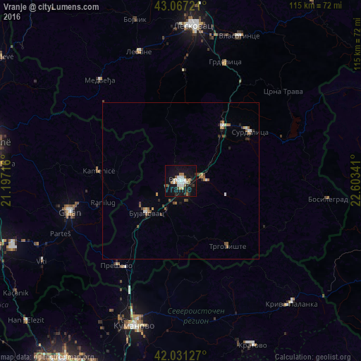

Analysis of Vranje night lights 2016
Square area 10x10 km:
 3.81%
3.81%90-99
6.98%80-89
1.27%70-79
0.79%60-69
4.92%50-59
2.54%40-49
1.27%30-39
2.06%20-29
3.49%10-19
36.83%0-9
36.03%Square area 50x50 km:
0.23%90-99
0.43%80-89
0.18%70-79
0.16%60-69
0.46%50-59
0.38%40-49
0.33%30-39
0.23%20-29
0.41%10-19
1.67%0-9
95.53%Clear (daylight) street map image can be seen on geolist.org.
Map coordinates:
43° 4' 2" North, 21° 11' 49.8" East
42° 33' 5" North, 21° 54' 1" East
42° 1' 52.6" North, 22° 36' 12.3" East
Some cities around Vranje sort by population:
• Leskovac
49.8 km =30.9 mi,  4°
4°
• Kumanovo, MK
49 km =30.4 mi,  198°
198°
• Gjilan, XK
36.7 km =22.8 mi,  254°
254°
• Lipkovo, MK
51 km =31.7 mi,  210°
210°
• Kamenica, XK
26.4 km =16.4 mi,  276°
276°
• Novo Brdo, XK
38.8 km =24.1 mi, 280°
• Старо Нагоричане, MK
39.7 km =24.7 mi,  188°
188°
• Ранковце, MK
46 km =28.6 mi,  157°
157°
784227 (p: 56,199)
Sources (retrieved 2019-11-25):
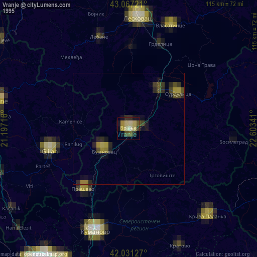
» NASA, Earths city lights 1995
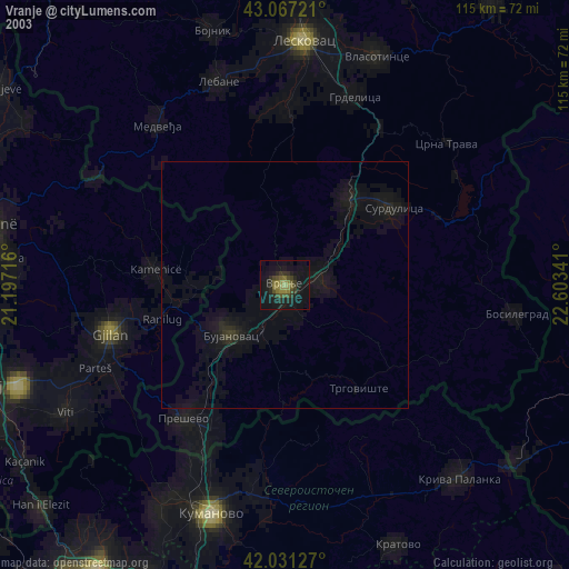
» NASA city lights 2003
» Earth at Night: Flat Maps 2012, 2016