Videle night lights from space
Night Light of Videle (Teleorman) from space (Romania) Src. Average luminocity for 10x10km area is 3.2682% and for 50x50km: 1.7515%.
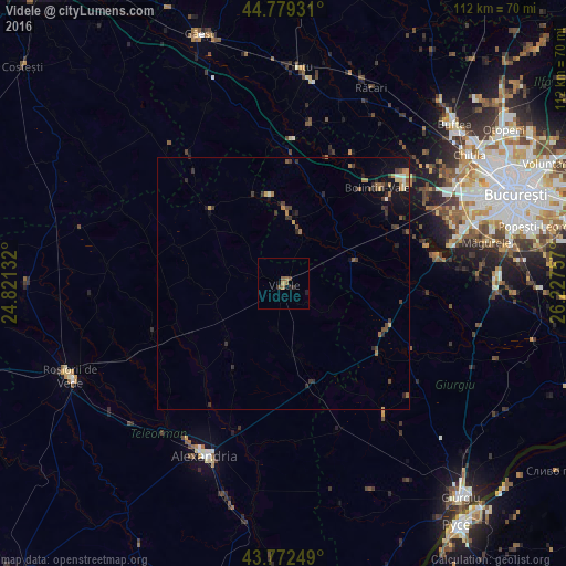
Analysis of Videle night lights 2016
Square area 10x10 km:
 0%
0%90-99
0%80-89
0%70-79
0%60-69
1.82%50-59
1.21%40-49
1.21%30-39
0.3%20-29
0.91%10-19
1.06%0-9
93.48%Square area 50x50 km:
0.04%90-99
0.14%80-89
0.12%70-79
0.2%60-69
0.44%50-59
0.3%40-49
0.39%30-39
0.54%20-29
0.58%10-19
1%0-9
96.26%Clear (daylight) street map image can be seen on geolist.org.
Map coordinates:
44° 46' 45.5" North, 24° 49' 16.8" East
44° 16' 41" North, 25° 31' 28" East
43° 46' 21" North, 26° 13' 39.3" East
Some cities around Videle sort by population:
• Bolintin Vale
26.5 km =16.5 mi,  44°
44°
• Roata de Jos
14.8 km =9.2 mi,  5°
5°
• Potlogi
30.6 km =19 mi, 8°
• Corbii Mari
30.3 km =18.8 mi,  356°
356°
• Orbeasca de Sus
21.8 km =13.5 mi,  229°
229°
• Botoroaga
14.5 km =9 mi,  173°
173°
• Băbăiţa
16.7 km =10.4 mi,  222°
222°
• Găiseni
28 km =17.4 mi,  20°
20°
662976 (p: 11,813)
Sources (retrieved 2019-11-25):
» Earth at Night: Flat Maps 2012, 2016