Roata de Jos night lights from space
Night Light of Roata de Jos (Giurgiu) from space (Romania) Src. Average luminocity for 10x10km area is 5.9111% and for 50x50km: 2.288%.
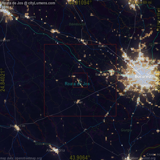
Analysis of Roata de Jos night lights 2016
Square area 10x10 km:
 0%
0%90-99
0.63%80-89
0%70-79
0.95%60-69
2.06%50-59
0.32%40-49
2.06%30-39
2.22%20-29
0.95%10-19
1.9%0-9
88.89%Square area 50x50 km:
0.06%90-99
0.16%80-89
0.18%70-79
0.23%60-69
0.42%50-59
0.36%40-49
0.63%30-39
0.66%20-29
0.6%10-19
1.78%0-9
94.93%Clear (daylight) street map image can be seen on geolist.org.
Map coordinates:
44° 54' 39.4" North, 24° 50' 24.8" East
44° 24' 39" North, 25° 32' 36" East
43° 54' 23" North, 26° 14' 47.3" East
Some cities around Roata de Jos sort by population:
• Videle
14.8 km =9.2 mi,  185°
185°
• Bolintin Vale
17.5 km =10.9 mi,  76°
76°
• Potlogi
15.8 km =9.8 mi,  11°
11°
• Corbii Mari
15.9 km =9.9 mi,  347°
347°
• Ulmi
20.6 km =12.8 mi,  65°
65°
• Bolintin Deal
22.7 km =14.1 mi, 76°
• Găiseni
14.1 km =8.8 mi,  34°
34°
• Odobeşti
23 km =14.3 mi,  4°
4°
668799 (p: 8,350)
Sources (retrieved 2019-11-25):
» Earth at Night: Flat Maps 2012, 2016