Tudora night lights from space
Night Light of Tudora (Botoşani) from space (Romania) Src. Average luminocity for 10x10km area is 0% and for 50x50km: 0.6066%.
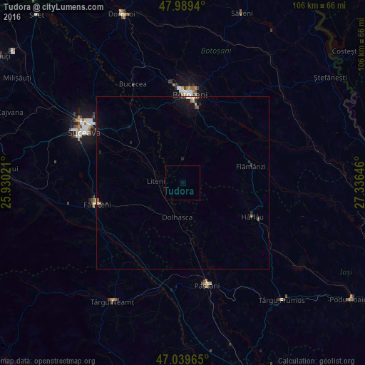
Analysis of Tudora night lights 2016
Square area 10x10 km:
 0%
0%90-99
0%80-89
0%70-79
0%60-69
0%50-59
0%40-49
0%30-39
0%20-29
0%10-19
0%0-9
100%Square area 50x50 km:
0.05%90-99
0.08%80-89
0.05%70-79
0.01%60-69
0.09%50-59
0.09%40-49
0.03%30-39
0.05%20-29
0.22%10-19
0.67%0-9
98.66%Clear (daylight) street map image can be seen on geolist.org.
Map coordinates:
47° 59' 21.8" North, 25° 55' 48.8" East
47° 31' 0" North, 26° 37' 60" East
47° 2' 22.7" North, 27° 20' 11.3" East
Some cities around Tudora sort by population:
• Storeşti
17.9 km =11.1 mi,  78°
78°
• Dolhasca
9.6 km =6 mi,  195°
195°
• Preuteşti
17.9 km =11.1 mi,  245°
245°
• Vorona Teodoru
4.5 km =2.8 mi,  325°
325°
• Udeşti
17.2 km =10.7 mi,  288°
288°
• Vereşti
17.6 km =10.9 mi,  301°
301°
• Corni
15.3 km =9.5 mi,  345°
345°
• Lespezi
17.4 km =10.8 mi,  163°
163°
664575 (p: 5,139)
Sources (retrieved 2019-11-25):
» Earth at Night: Flat Maps 2012, 2016