Preuteşti night lights from space
Night Light of Preuteşti (Suceava) from space (Romania) Src. Average luminocity for 10x10km area is 0.0241% and for 50x50km: 1.5577%.
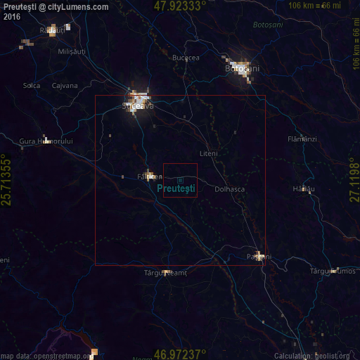
Analysis of Preuteşti night lights 2016
Square area 10x10 km:
 0%
0%90-99
0%80-89
0%70-79
0%60-69
0%50-59
0%40-49
0%30-39
0%20-29
0%10-19
0%0-9
100%Square area 50x50 km:
0.3%90-99
0.32%80-89
0.18%70-79
0.05%60-69
0.19%50-59
0.14%40-49
0.29%30-39
0.08%20-29
0.34%10-19
1.11%0-9
97.01%Clear (daylight) street map image can be seen on geolist.org.
Map coordinates:
47° 55' 24" North, 25° 42' 48.8" East
47° 27' 0" North, 26° 25' 0" East
46° 58' 20.5" North, 27° 7' 11.3" East
Some cities around Preuteşti sort by population:
• Fălticeni
8.8 km =5.5 mi,  270°
270°
• Dolhasca
13.9 km =8.6 mi,  97°
97°
• Vorona Teodoru
17.7 km =11 mi,  51°
51°
• Vadu Moldovei
8.3 km =5.2 mi,  206°
206°
• Udeşti
13 km =8.1 mi,  0°
0°
• Vereşti
16.7 km =10.4 mi, 4°
• Baia
15.5 km =9.6 mi,  256°
256°
• Bosanci
16.6 km =10.3 mi,  333°
333°
669665 (p: 9,048)
Sources (retrieved 2019-11-25):
» Earth at Night: Flat Maps 2012, 2016