Tătărani night lights from space
Night Light of Tătărani (Dâmboviţa) from space (Romania) Src. Average luminocity for 10x10km area is 0.0063% and for 50x50km: 3.1626%.
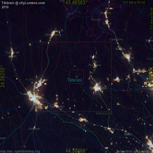
Analysis of Tătărani night lights 2016
Square area 10x10 km:
 0%
0%90-99
0%80-89
0%70-79
0%60-69
0%50-59
0%40-49
0%30-39
0%20-29
0%10-19
0%0-9
100%Square area 50x50 km:
0.38%90-99
0.34%80-89
0.21%70-79
0.31%60-69
0.41%50-59
0.37%40-49
0.49%30-39
0.46%20-29
0.8%10-19
3.12%0-9
93.1%Clear (daylight) street map image can be seen on geolist.org.
Map coordinates:
45° 29' 42.1" North, 24° 33' 48.8" East
45° 0' 0" North, 25° 16' 0" East
44° 30' 2.4" North, 25° 58' 11.3" East
Some cities around Tătărani sort by population:
• Pucioasa
15.6 km =9.7 mi,  56°
56°
• Brăneşti
12.4 km =7.7 mi,  72°
72°
• Dragomireşti
10.6 km =6.6 mi,  150°
150°
• Izvoarele
3.7 km =2.3 mi,  0°
0°
• Bărbuleţu
15.1 km =9.4 mi,  10°
10°
• Voineşti
7.5 km =4.7 mi,  349°
349°
• Aninoasa
13.6 km =8.5 mi,  105°
105°
• Ludeşti
15.1 km =9.4 mi,  190°
190°
665459 (p: 5,422)
Sources (retrieved 2019-11-25):
» Earth at Night: Flat Maps 2012, 2016