Bărbuleţu night lights from space
Night Light of Bărbuleţu (Dâmboviţa) from space (Romania) Src. Average luminocity for 10x10km area is 0.0061% and for 50x50km: 2.488%.
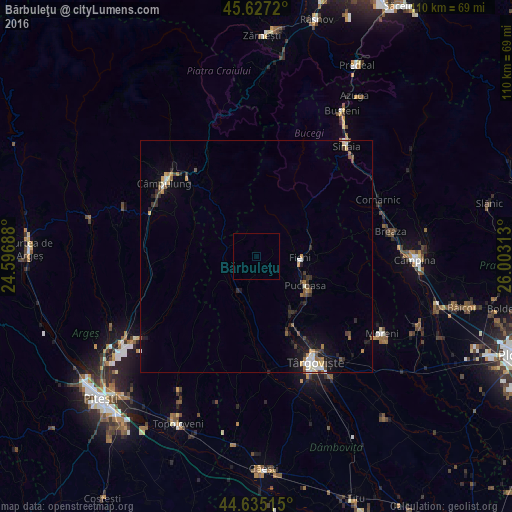
Analysis of Bărbuleţu night lights 2016
Square area 10x10 km:
 0%
0%90-99
0%80-89
0%70-79
0%60-69
0%50-59
0%40-49
0%30-39
0%20-29
0%10-19
0%0-9
100%Square area 50x50 km:
0.33%90-99
0.27%80-89
0.2%70-79
0.3%60-69
0.28%50-59
0.36%40-49
0.38%30-39
0.39%20-29
0.57%10-19
1.52%0-9
95.39%Clear (daylight) street map image can be seen on geolist.org.
Map coordinates:
45° 37' 37.9" North, 24° 35' 48.8" East
45° 7' 60" North, 25° 18' 0" East
44° 38' 6.5" North, 26° 0' 11.3" East
Some cities around Bărbuleţu sort by population:
• Pucioasa
12.1 km =7.5 mi,  120°
120°
• Brăneşti
14.4 km =8.9 mi,  140°
140°
• Fieni
9.2 km =5.7 mi,  90°
90°
• Izvoarele
11.4 km =7.1 mi,  193°
193°
• Voineşti
8.4 km =5.2 mi,  207°
207°
• Tătărani
15.1 km =9.4 mi, 190°
• Bezdead
17.1 km =10.6 mi,  83°
83°
• Moroeni
14 km =8.7 mi,  48°
48°
685366 (p: 6,777)
Sources (retrieved 2019-11-25):
» Earth at Night: Flat Maps 2012, 2016