Slobozia night lights from space
Night Light of Slobozia (Arges) from space (Romania) Src. Average luminocity for 10x10km area is 0.8651% and for 50x50km: 1.0527%.
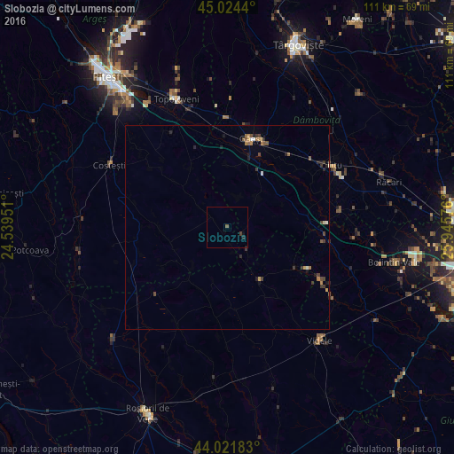
Analysis of Slobozia night lights 2016
Square area 10x10 km:
 0%
0%90-99
0%80-89
0%70-79
0%60-69
0%50-59
0.63%40-49
0.32%30-39
0.32%20-29
0.63%10-19
0.32%0-9
97.78%Square area 50x50 km:
0.03%90-99
0.1%80-89
0.04%70-79
0.14%60-69
0.21%50-59
0.22%40-49
0.25%30-39
0.32%20-29
0.31%10-19
0.23%0-9
98.15%Clear (daylight) street map image can be seen on geolist.org.
Map coordinates:
45° 1' 27.8" North, 24° 32' 22.2" East
44° 31' 31" North, 25° 14' 33.5" East
44° 1' 18.6" North, 25° 56' 44.7" East
Some cities around Slobozia sort by population:
• Găeşti
22.1 km =13.7 mi,  15°
15°
• Titu
26.9 km =16.7 mi,  58°
58°
• Corbii Mari
20.6 km =12.8 mi,  82°
82°
• Dragodana
24.6 km =15.3 mi, 20°
• Vişina
9.7 km =6 mi,  48°
48°
• Buzoeşti
26.6 km =16.5 mi,  284°
284°
• Petreşti
15.6 km =9.7 mi,  27°
27°
• Mătăsaru
25.4 km =15.8 mi, 32°
666716 (p: 5,045)
Sources (retrieved 2019-11-25):
» Earth at Night: Flat Maps 2012, 2016