Puieşti night lights from space
Night Light of Puieşti (Vaslui) from space (Romania) Src. Average luminocity for 10x10km area is 0% and for 50x50km: 0.8713%.
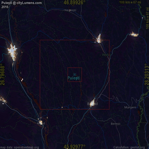
Analysis of Puieşti night lights 2016
Square area 10x10 km:
 0%
0%90-99
0%80-89
0%70-79
0%60-69
0%50-59
0%40-49
0%30-39
0%20-29
0%10-19
0%0-9
100%Square area 50x50 km:
0.2%90-99
0.16%80-89
0.06%70-79
0.16%60-69
0.01%50-59
0.05%40-49
0.05%30-39
0.12%20-29
0.03%10-19
0.33%0-9
98.84%Clear (daylight) street map image can be seen on geolist.org.
Map coordinates:
46° 53' 57.3" North, 26° 47' 48.8" East
46° 25' 0" North, 27° 30' 0" East
45° 55' 47.2" North, 28° 12' 11.3" East
Some cities around Puieşti sort by population:
• Bârlad
24.3 km =15.1 mi,  147°
147°
• Zorleni
23.6 km =14.7 mi,  135°
135°
• Laza
26.7 km =16.6 mi,  13°
13°
• Banca
26.4 km =16.4 mi,  119°
119°
• Corbasca
29.6 km =18.4 mi,  239°
239°
• Perieni
15.8 km =9.8 mi, 145°
• Podu Turcului
25.7 km =16 mi,  200°
200°
• Răchitoasa
10.4 km =6.5 mi,  280°
280°
669499 (p: 5,050)
Sources (retrieved 2019-11-25):
» Earth at Night: Flat Maps 2012, 2016