Podu Turcului night lights from space
Night Light of Podu Turcului (Bacău) from space (Romania) Src. Average luminocity for 10x10km area is 0.3352% and for 50x50km: 0.8295%.
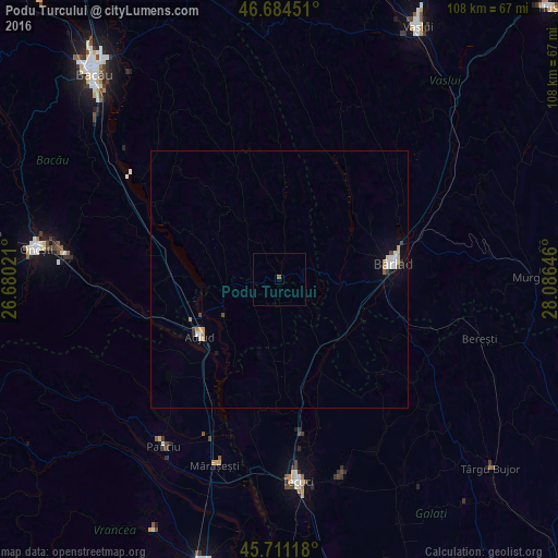
Analysis of Podu Turcului night lights 2016
Square area 10x10 km:
 0%
0%90-99
0%80-89
0%70-79
0%60-69
0%50-59
0.57%40-49
0%30-39
0%20-29
0%10-19
0%0-9
99.43%Square area 50x50 km:
0.15%90-99
0.14%80-89
0.08%70-79
0.14%60-69
0.07%50-59
0.05%40-49
0.12%30-39
0.05%20-29
0.05%10-19
0.2%0-9
98.95%Clear (daylight) street map image can be seen on geolist.org.
Map coordinates:
46° 41' 4.2" North, 26° 40' 48.8" East
46° 12' 0" North, 27° 22' 60" East
45° 42' 40.2" North, 28° 5' 11.3" East
Some cities around Podu Turcului sort by population:
• Adjud
20.1 km =12.5 mi,  236°
236°
• Homocea
13.7 km =8.5 mi, 237°
• Brăhăşeştii de Sus
16.9 km =10.5 mi,  188°
188°
• Ghidigeni
18.9 km =11.7 mi,  151°
151°
• Tutova
15.8 km =9.8 mi,  125°
125°
• Griviţa
21.3 km =13.2 mi,  105°
105°
• Corbasca
19.1 km =11.9 mi,  299°
299°
• Perieni
21.1 km =13.1 mi,  58°
58°
670257 (p: 5,081)
Sources (retrieved 2019-11-25):
» Earth at Night: Flat Maps 2012, 2016