Podari night lights from space
Night Light of Podari (Dolj) from space (Romania) Src. Average luminocity for 10x10km area is 16.0455% and for 50x50km: 4.9172%.
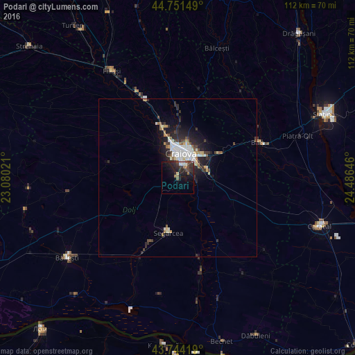
Analysis of Podari night lights 2016
Square area 10x10 km:
 1.21%
1.21%90-99
2.42%80-89
0.61%70-79
0.3%60-69
2.73%50-59
1.52%40-49
2.58%30-39
4.85%20-29
11.21%10-19
15.76%0-9
56.82%Square area 50x50 km:
0.83%90-99
1.07%80-89
0.46%70-79
0.33%60-69
0.51%50-59
0.43%40-49
0.57%30-39
0.83%20-29
1.96%10-19
3.15%0-9
89.86%Clear (daylight) street map image can be seen on geolist.org.
Map coordinates:
44° 45' 5.4" North, 23° 4' 48.8" East
44° 15' 0" North, 23° 46' 60" East
43° 44' 39.1" North, 24° 29' 11.3" East
Some cities around Podari sort by population:
• Craiova
7.5 km =4.7 mi,  10°
10°
• Balş
27.5 km =17.1 mi,  66°
66°
• Segarcea
16.9 km =10.5 mi,  189°
189°
• Dăneţi
36.5 km =22.7 mi,  144°
144°
• Valea Stanciului
30.4 km =18.9 mi,  167°
167°
• Leu
18.8 km =11.7 mi,  113°
113°
• Celaru
35.7 km =22.2 mi,  128°
128°
• Coşoveni
11.9 km =7.4 mi,  90°
90°
670353 (p: 6,302)
Sources (retrieved 2019-11-25):
» Earth at Night: Flat Maps 2012, 2016