Olteniţa night lights from space
Night Light of Olteniţa (Călăraşi) from space (Romania) Src. Average luminocity for 10x10km area is 12.3121% and for 50x50km: 1.2683%.
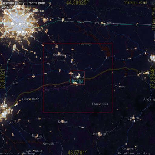
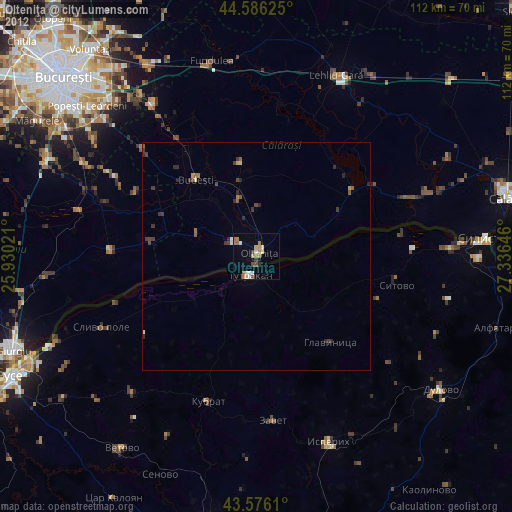
Analysis of Olteniţa night lights 2016
Square area 10x10 km:
 0.61%
0.61%90-99
1.82%80-89
1.21%70-79
2.88%60-69
2.58%50-59
0.76%40-49
3.48%30-39
0%20-29
1.21%10-19
0.61%0-9
84.85%Square area 50x50 km:
0.02%90-99
0.12%80-89
0.08%70-79
0.27%60-69
0.2%50-59
0.14%40-49
0.41%30-39
0.36%20-29
0.18%10-19
0.25%0-9
97.96%Clear (daylight) street map image can be seen on geolist.org.
Map coordinates:
44° 35' 10.5" North, 25° 55' 48.8" East
44° 4' 60" North, 26° 37' 60" East
43° 34' 34" North, 27° 20' 11.3" East
Some cities around Olteniţa sort by population:
• Tutrakan, BG
4.2 km =2.6 mi,  204°
204°
• Budeşti
21.5 km =13.4 mi,  321°
321°
• Hotarele
23.2 km =14.4 mi,  295°
295°
• Chirnogi
6.5 km =4 mi, 304°
• Mânăstirea
25.9 km =16.1 mi,  55°
55°
• Ulmeni
10 km =6.2 mi,  41°
41°
• Curcani
13.6 km =8.5 mi,  342°
342°
• Radovanu
16 km =9.9 mi, 324°
671832 (p: 26,356)
Sources (retrieved 2019-11-25):
» Earth at Night: Flat Maps 2012, 2016