Gherla night lights from space
Night Light of Gherla (Cluj) from space (Romania) Src. Average luminocity for 10x10km area is 3.7088% and for 50x50km: 1.0605%.
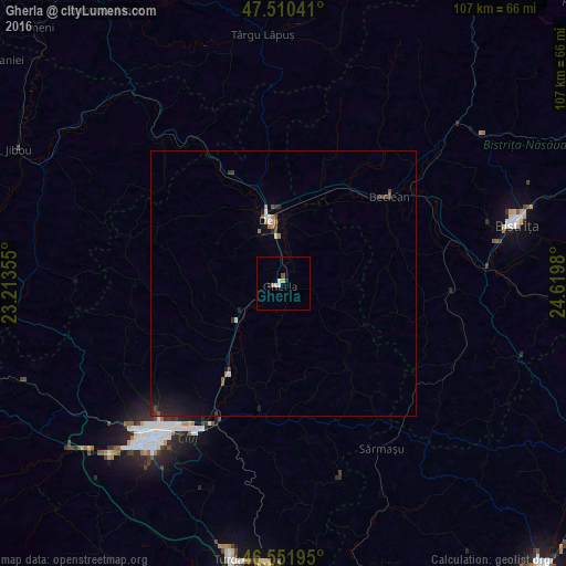
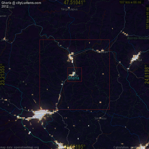
Analysis of Gherla night lights 2016
Square area 10x10 km:
 0.85%
0.85%90-99
0.85%80-89
0%70-79
0.57%60-69
0.57%50-59
0%40-49
0.57%30-39
0%20-29
0.57%10-19
0.57%0-9
95.45%Square area 50x50 km:
0.08%90-99
0.13%80-89
0.02%70-79
0.09%60-69
0.16%50-59
0.11%40-49
0.24%30-39
0.16%20-29
0.33%10-19
0.87%0-9
97.79%Clear (daylight) street map image can be seen on geolist.org.
Map coordinates:
47° 30' 37.5" North, 23° 12' 48.8" East
47° 1' 60" North, 23° 55' 0" East
46° 33' 7" North, 24° 37' 11.3" East
Some cities around Gherla sort by population:
• Cluj-Napoca
38.2 km =23.7 mi,  219°
219°
• Dej
13.5 km =8.4 mi,  343°
343°
• Beclean
26.2 km =16.3 mi,  50°
50°
• Apahida
27.2 km =16.9 mi,  207°
207°
• Baciu
40 km =24.9 mi,  229°
229°
• Sărmaşu
36.8 km =22.9 mi,  148°
148°
• Lechinţa
32.9 km =20.4 mi,  93°
93°
• Căianu Mic
28.4 km =17.6 mi,  38°
38°
677429 (p: 23,741)
Sources (retrieved 2019-11-25):
» Earth at Night: Flat Maps 2012, 2016