Comarnic night lights from space
Night Light of Comarnic (Prahova) from space (Romania) Src. Average luminocity for 10x10km area is 1.397% and for 50x50km: 2.5094%.
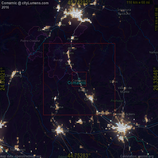
Analysis of Comarnic night lights 2016
Square area 10x10 km:
 0%
0%90-99
0%80-89
0%70-79
0%60-69
0%50-59
0%40-49
0.61%30-39
0.61%20-29
1.97%10-19
1.36%0-9
95.45%Square area 50x50 km:
0.18%90-99
0.2%80-89
0.19%70-79
0.25%60-69
0.37%50-59
0.43%40-49
0.81%30-39
0.36%20-29
0.72%10-19
0.82%0-9
95.67%Clear (daylight) street map image can be seen on geolist.org.
Map coordinates:
45° 44' 34.3" North, 24° 55' 48.8" East
45° 15' 0" North, 25° 37' 60" East
44° 45' 10.2" North, 26° 20' 11.3" East
Some cities around Comarnic sort by population:
• Câmpina
15.9 km =9.9 mi,  149°
149°
• Breaza
7.9 km =4.9 mi,  160°
160°
• Sinaia
12.9 km =8 mi,  329°
329°
• Breaza de Sus
6 km =3.7 mi, 162°
• Brebu Mânăstirei
12.8 km =8 mi,  125°
125°
• Poiana Câmpina
13.6 km =8.5 mi, 163°
• Bezdead
14.4 km =8.9 mi,  219°
219°
• Moroeni
16.1 km =10 mi,  256°
256°
681005 (p: 13,254)
Sources (retrieved 2019-11-25):
» Earth at Night: Flat Maps 2012, 2016