Moroeni night lights from space
Night Light of Moroeni (Dâmboviţa) from space (Romania) Src. Average luminocity for 10x10km area is 0% and for 50x50km: 1.9305%.
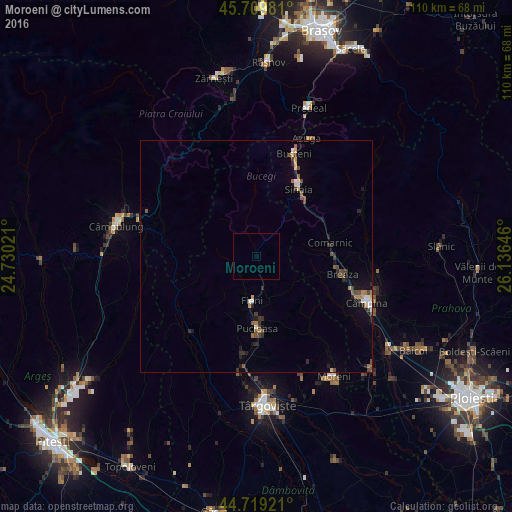
Analysis of Moroeni night lights 2016
Square area 10x10 km:
 0%
0%90-99
0%80-89
0%70-79
0%60-69
0%50-59
0%40-49
0%30-39
0%20-29
0%10-19
0%0-9
100%Square area 50x50 km:
0.18%90-99
0.17%80-89
0.17%70-79
0.2%60-69
0.22%50-59
0.25%40-49
0.6%30-39
0.26%20-29
0.56%10-19
0.7%0-9
96.69%Clear (daylight) street map image can be seen on geolist.org.
Map coordinates:
45° 42' 35.3" North, 24° 43' 48.8" East
45° 13' 0" North, 25° 25' 60" East
44° 43' 9.2" North, 26° 8' 11.3" East
Some cities around Moroeni sort by population:
• Breaza
18.7 km =11.6 mi,  101°
101°
• Pucioasa
15.4 km =9.6 mi,  180°
180°
• Comarnic
16.1 km =10 mi,  76°
76°
• Sinaia
17.4 km =10.8 mi,  31°
31°
• Breaza de Sus
17.5 km =10.9 mi, 96°
• Fieni
9.4 km =5.8 mi,  188°
188°
• Bărbuleţu
14 km =8.7 mi,  228°
228°
• Bezdead
9.9 km =6.2 mi,  138°
138°
672847 (p: 5,042)
Sources (retrieved 2019-11-25):
» Earth at Night: Flat Maps 2012, 2016