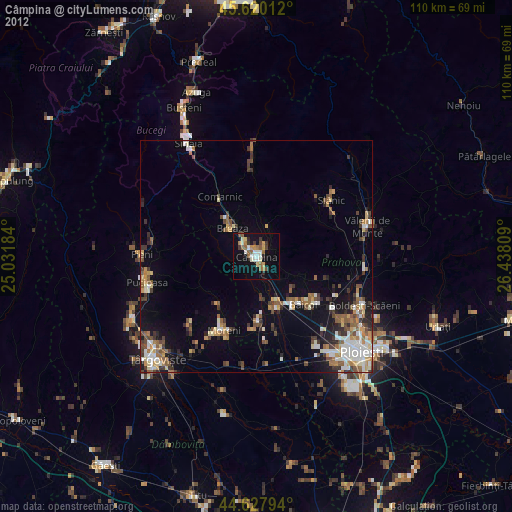
Câmpina night lights from space
Night Light of Câmpina (Prahova) from space (Romania) Src. Average luminocity for 10x10km area is 18.2833% and for 50x50km: 7.2757%.
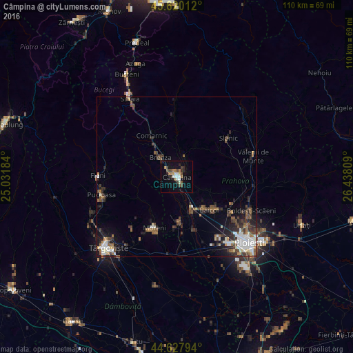
Analysis of Câmpina night lights 2016
Square area 10x10 km:
 2.73%
2.73%90-99
2.73%80-89
0.61%70-79
1.97%60-69
3.48%50-59
0.61%40-49
4.7%30-39
1.82%20-29
3.94%10-19
10.76%0-9
66.67%Square area 50x50 km:
1.24%90-99
1.2%80-89
0.43%70-79
0.54%60-69
0.87%50-59
1.03%40-49
1.62%30-39
1.37%20-29
1.94%10-19
3.61%0-9
86.14%Clear (daylight) street map image can be seen on geolist.org.
Map coordinates:
45° 37' 12.4" North, 25° 1' 54.6" East
45° 7' 34.3" North, 25° 44' 5.9" East
44° 37' 40.6" North, 26° 26' 17.1" East
Some cities around Câmpina sort by population:
• Breaza
8.3 km =5.2 mi,  319°
319°
• Brebu Mânăstirei
6.8 km =4.2 mi,  21°
21°
• Floreşti
9.3 km =5.8 mi,  155°
155°
• Doftana
5.7 km =3.5 mi,  62°
62°
• Măgureni
6.6 km =4.1 mi,  181°
181°
• Telega
3.9 km =2.4 mi,  78°
78°
• Băneşti
3.8 km =2.4 mi,  139°
139°
• Poiana Câmpina
4.1 km =2.5 mi,  281°
281°
681862 (p: 41,554)
Sources (retrieved 2019-11-25):
» Earth at Night: Flat Maps 2012, 2016