Sector 4 night lights from space
Night Light of Sector 4 (Bucureşti) from space (Romania) Src. Average luminocity for 10x10km area is 78.4048% and for 50x50km: 26.387%.
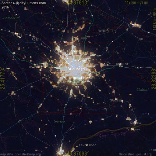
Analysis of Sector 4 night lights 2016
Square area 10x10 km:
 29.05%
90-99
23.65%80-89
4.44%70-79
7.46%60-69
6.83%50-59
9.05%40-49
10.48%30-39
7.46%20-29
1.59%10-19
0%0-9
0%Square area 50x50 km:
6.59%90-99
5.74%80-89
2.53%70-79
2.88%60-69
2.96%50-59
3.04%40-49
3.82%30-39
3.12%20-29
6.11%10-19
9.75%0-9
53.47%Clear (daylight) street map image can be seen on geolist.org.
Map coordinates:
44° 52' 34.1" North, 25° 25' 3.8" East
44° 22' 32.6" North, 26° 7' 15.1" East
43° 52' 15.5" North, 26° 49' 26.3" East
Some cities around Sector 4 sort by population:
• Bucharest
6.4 km =4 mi,  349°
349°
• Pantelimon
10.4 km =6.5 mi,  37°
37°
• Popeşti-Leordeni
3.7 km =2.3 mi,  76°
76°
• Jilava
5.8 km =3.6 mi,  215°
215°
• Măgurele
7.5 km =4.7 mi,  247°
247°
• 1 Decembrie
10.7 km =6.6 mi,  207°
207°
• Glina
10.3 km =6.4 mi,  85°
85°
• Dobroeşti
9.6 km =6 mi,  30°
30°
11048320 (p: 287,828)
Sources (retrieved 2019-11-25):
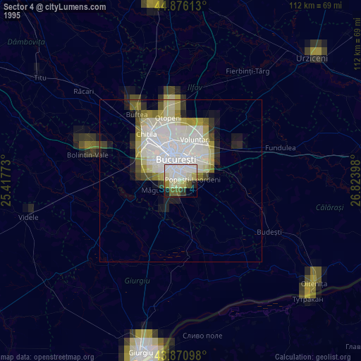
» NASA, Earths city lights 1995
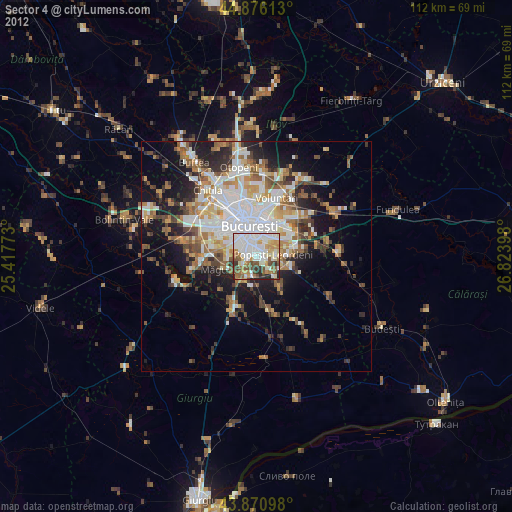
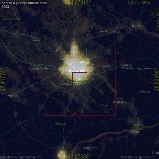
» NASA city lights 2003
» Earth at Night: Flat Maps 2012, 2016