Sector 5 night lights from space
Night Light of Sector 5 (Bucureşti) from space (Romania) Src. Average luminocity for 10x10km area is 82.7603% and for 50x50km: 27.1445%.
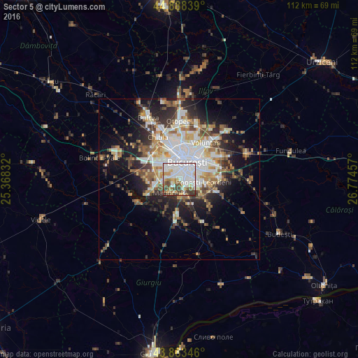
Analysis of Sector 5 night lights 2016
Square area 10x10 km:
 36.67%
90-99
24.13%80-89
3.81%70-79
6.83%60-69
6.83%50-59
6.83%40-49
9.52%30-39
4.92%20-29
0.48%10-19
0%0-9
0%Square area 50x50 km:
6.6%90-99
5.82%80-89
2.63%70-79
3.01%60-69
3.13%50-59
3.09%40-49
3.92%30-39
3.33%20-29
6.35%10-19
10.51%0-9
51.6%Clear (daylight) street map image can be seen on geolist.org.
Map coordinates:
44° 53' 18.2" North, 25° 22' 6" East
44° 23' 17.1" North, 26° 4' 17.2" East
43° 53' 0.5" North, 26° 46' 28.5" East
Some cities around Sector 5 sort by population:
• Bucharest
5.6 km =3.5 mi,  29°
29°
• Popeşti-Leordeni
7.6 km =4.7 mi,  93°
93°
• Jilava
6.1 km =3.8 mi,  175°
175°
• Măgurele
5.2 km =3.2 mi,  215°
215°
• Bragadiru
7.7 km =4.8 mi,  255°
255°
• Chiajna
11.2 km =7 mi,  315°
315°
• 1 Decembrie
10.9 km =6.8 mi,  185°
185°
• Dobroeşti
11.2 km =7 mi,  52°
52°
11048322 (p: 271,575)
Sources (retrieved 2019-11-25):
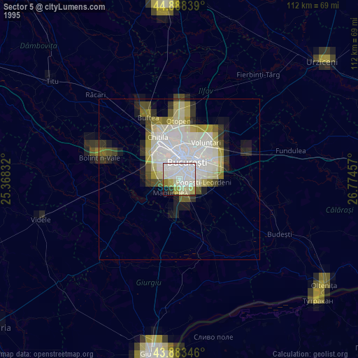
» NASA, Earths city lights 1995
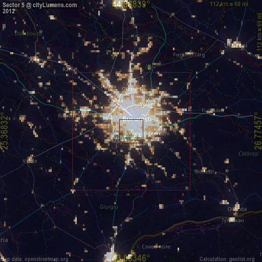
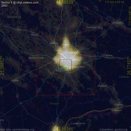
» NASA city lights 2003
» Earth at Night: Flat Maps 2012, 2016