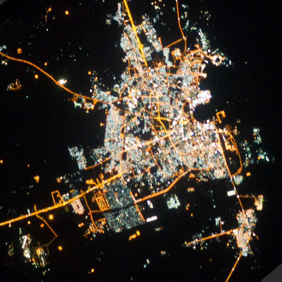
Doha night lights from space
Night Light of Doha (Baladīyat ad Dawḩah) from space (Qatar) Src. Average luminocity for 10x10km area is 96.744% and for 50x50km: 59.2645%.
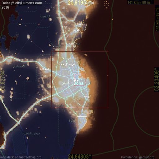
Analysis of Doha night lights 2016
Square area 10x10 km:
 64.88%
90-99
21.23%80-89
6.35%70-79
7.54%60-69
0%50-59
0%40-49
0%30-39
0%20-29
0%10-19
0%0-9
0%Square area 50x50 km:
18.68%90-99
14.35%80-89
7.59%70-79
9.72%60-69
11.32%50-59
3.94%40-49
2.83%30-39
2.8%20-29
2.37%10-19
3.75%0-9
22.65%Clear (daylight) street map image can be seen on geolist.org.
Map coordinates:
25° 55' 10.3" North, 50° 49' 40.2" East
25° 17' 7.6" North, 51° 31' 51.5" East
24° 38' 52.9" North, 52° 14' 2.7" East
Fantastic image of Doha from space taken by astronauts [src2], but I don't have information about it's orientation, scale or angle. If necessary, it was rotated manually, so North points approximately to upper direction. Click to zoom in:
Some cities around Doha sort by population:
• Ar Rayyān
10.7 km =6.6 mi,  273°
273°
• Umm Şalāl Muḩammad
19.1 km =11.9 mi,  319°
319°
• Al Wakrah
14.6 km =9.1 mi,  150°
150°
• Ash Shīḩānīyah
32.4 km =20.1 mi,  287°
287°
• Musay‘īd
32.7 km =20.3 mi,  176°
176°
• Al Wukayr
15 km =9.3 mi, 177°
• Az̧ Z̧a‘āyin
32.8 km =20.4 mi,  351°
351°
• Umm Şalāl ‘Alī
24.5 km =15.2 mi,  326°
326°
290030 (p: 344,939)
Sources (retrieved 2019-11-25):
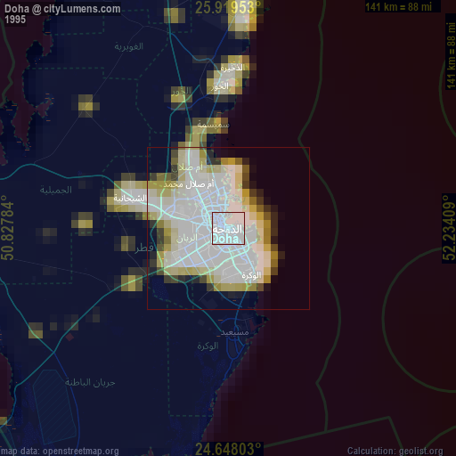
» NASA, Earths city lights 1995
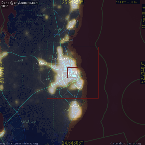
» NASA city lights 2003
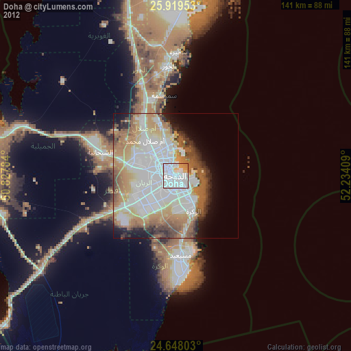
» Earth at Night: Flat Maps 2012, 2016
Src.2: NASA.gov, ID: ISS026-E-9184, 2010-12-09