Limpio night lights from space
Night Light of Limpio (Central) from space (Paraguay) Src. Average luminocity for 10x10km area is 71.8313% and for 50x50km: 32.7292%.
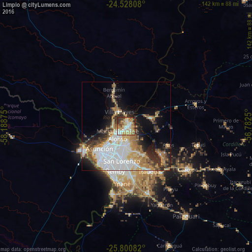
Analysis of Limpio night lights 2016
Square area 10x10 km:
 12.9%
12.9%90-99
17.46%80-89
13.29%70-79
15.48%60-69
16.07%50-59
4.96%40-49
4.76%30-39
7.94%20-29
6.94%10-19
0.2%0-9
0%Square area 50x50 km:
10.2%90-99
5.62%80-89
3.46%70-79
4.47%60-69
4.81%50-59
2.82%40-49
3.65%30-39
3.51%20-29
5.4%10-19
8.71%0-9
47.35%Clear (daylight) street map image can be seen on geolist.org.
Map coordinates:
24° 31' 41.1" South, 58° 11' 19.5" West
25° 9' 58" South, 57° 29' 8.2" West
25° 48' 3" South, 56° 46' 57" West
Some cities around Limpio sort by population:
• Asunción
21 km =13 mi,  230°
230°
• San Lorenzo
19.4 km =12.1 mi,  186°
186°
• Capiatá
21.4 km =13.3 mi,  169°
169°
• Fernando de la Mora
19.5 km =12.1 mi, 190°
• Mariano Roque Alonso
6.6 km =4.1 mi, 225°
• Villa Hayes
9 km =5.6 mi,  334°
334°
• Areguá
19.2 km =11.9 mi,  148°
148°
• Emboscada
13.8 km =8.6 mi,  82°
82°
3437842 (p: 96,143)
Sources (retrieved 2019-11-25):
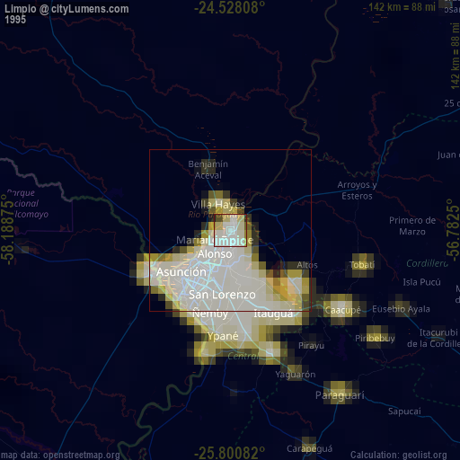
» NASA, Earths city lights 1995
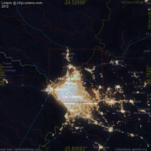
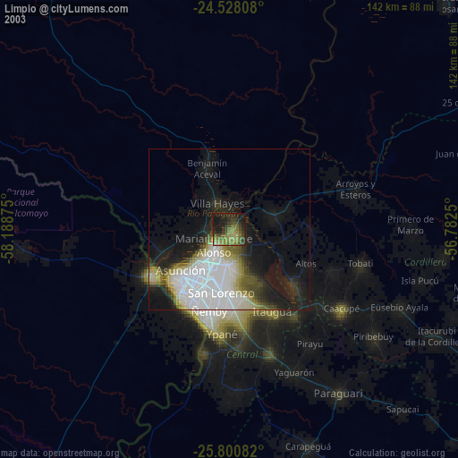
» NASA city lights 2003
» Earth at Night: Flat Maps 2012, 2016