Asunción night lights from space
Night Light of Asunción from space (Paraguay) Src. Average luminocity for 10x10km area is 73.496% and for 50x50km: 34.8023%.
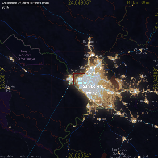
Analysis of Asunción night lights 2016
Square area 10x10 km:
 31.75%
90-99
14.29%80-89
2.98%70-79
6.15%60-69
5.75%50-59
12.3%40-49
14.48%30-39
8.33%20-29
3.97%10-19
0%0-9
0%Square area 50x50 km:
11.53%90-99
6.85%80-89
4.6%70-79
4.65%60-69
5.09%50-59
2.58%40-49
2.87%30-39
2.82%20-29
3.95%10-19
7.06%0-9
48.01%Clear (daylight) street map image can be seen on geolist.org.
Map coordinates:
24° 38' 56.6" South, 58° 21' 0.5" West
25° 17' 11.3" South, 57° 38' 49.2" West
25° 55' 13.9" South, 56° 56' 38" West
Some cities around Asunción sort by population:
• San Lorenzo
15.1 km =9.4 mi,  113°
113°
• Lambaré
7.9 km =4.9 mi,  148°
148°
• Fernando de la Mora
13.9 km =8.6 mi, 114°
• Nemby
16.4 km =10.2 mi,  137°
137°
• Mariano Roque Alonso
14.5 km =9 mi,  52°
52°
• Villa Elisa
10.5 km =6.5 mi, 148°
• Clorinda, AR
7.2 km =4.5 mi,  271°
271°
• Nanawua
5.7 km =3.5 mi,  278°
278°
3439389 (p: 1,482,200)
Sources (retrieved 2019-11-25):
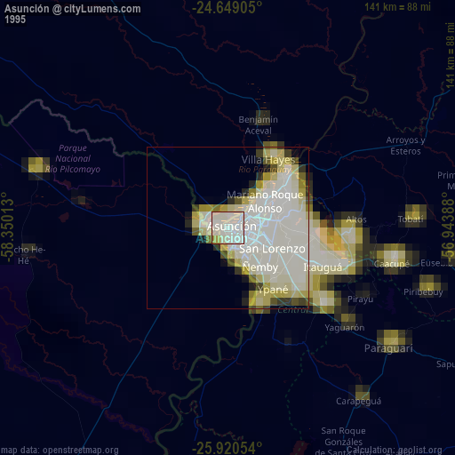
» NASA, Earths city lights 1995
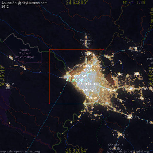
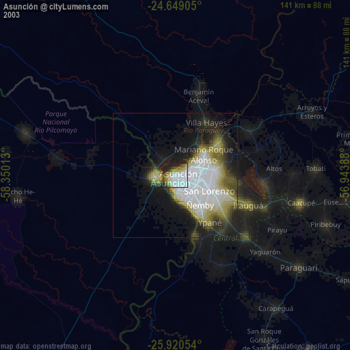
» NASA city lights 2003
» Earth at Night: Flat Maps 2012, 2016