Lambaré night lights from space
Night Light of Lambaré (Central) from space (Paraguay) Src. Average luminocity for 10x10km area is 94.1111% and for 50x50km: 38.7474%.
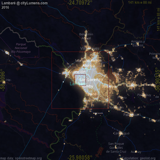
Analysis of Lambaré night lights 2016
Square area 10x10 km:
 76.79%
90-99
11.31%80-89
0.79%70-79
1.59%60-69
1.79%50-59
1.59%40-49
3.57%30-39
1.19%20-29
1.39%10-19
0%0-9
0%Square area 50x50 km:
11.64%90-99
7.27%80-89
5.27%70-79
5.43%60-69
6.5%50-59
3.31%40-49
3.46%30-39
3.41%20-29
4.73%10-19
8.75%0-9
40.24%Clear (daylight) street map image can be seen on geolist.org.
Map coordinates:
24° 42' 35" South, 58° 18' 34.6" West
25° 20' 48.6" South, 57° 36' 23.3" West
25° 58' 50.1" South, 56° 54' 12.1" West
Some cities around Lambaré sort by population:
• Asunción
7.9 km =4.9 mi,  328°
328°
• San Lorenzo
9.8 km =6.1 mi,  85°
85°
• Fernando de la Mora
8.6 km =5.3 mi,  83°
83°
• Nemby
8.9 km =5.5 mi,  126°
126°
• Villa Elisa
2.7 km =1.7 mi,  149°
149°
• San Antonio
10.2 km =6.3 mi,  144°
144°
• Clorinda, AR
13.2 km =8.2 mi,  301°
301°
• Nanawua
12.3 km =7.6 mi,  307°
307°
3437863 (p: 126,377)
Sources (retrieved 2019-11-25):
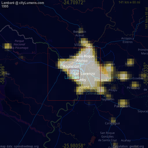
» NASA, Earths city lights 1995
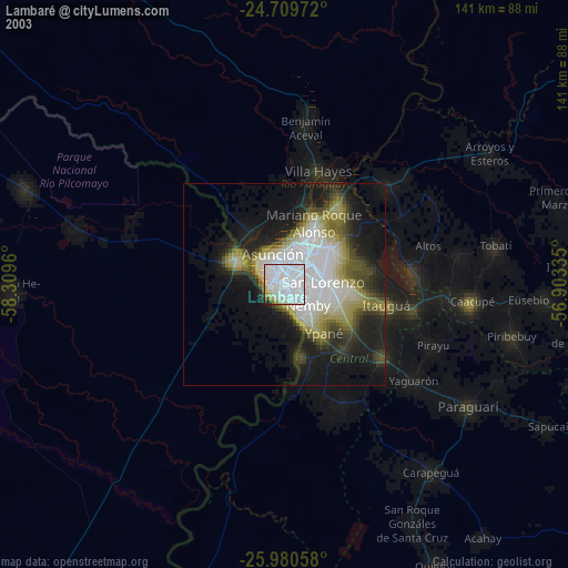
» NASA city lights 2003
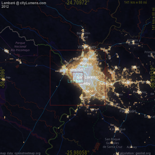
» Earth at Night: Flat Maps 2012, 2016