Encarnación night lights from space
Night Light of Encarnación (Itapúa) from space (Paraguay) Src. Average luminocity for 10x10km area is 81.7083% and for 50x50km: 16.0549%.
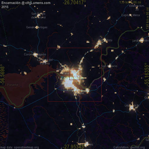
Analysis of Encarnación night lights 2016
Square area 10x10 km:
 28.79%
90-99
20.83%80-89
9.47%70-79
10.23%60-69
12.88%50-59
7.39%40-49
7.77%30-39
2.65%20-29
0%10-19
0%0-9
0%Square area 50x50 km:
3.06%90-99
2.23%80-89
2.56%70-79
1.9%60-69
2.13%50-59
1.5%40-49
2.48%30-39
2.92%20-29
3.98%10-19
8.11%0-9
69.12%Clear (daylight) street map image can be seen on geolist.org.
Map coordinates:
26° 42' 15" South, 56° 34' 11.3" West
27° 19' 50" South, 55° 52' 0" West
27° 57' 12.3" South, 55° 9' 48.8" West
Some cities around Encarnación sort by population:
• Posadas, AR
5 km =3.1 mi,  215°
215°
• Garupá, AR
17.2 km =10.7 mi,  167°
167°
• Candelaria, AR
18.7 km =11.6 mi,  140°
140°
• San José, AR
49.5 km =30.8 mi, 170°
• Obligado
40.3 km =25 mi,  34°
34°
• Gobernador Roca, AR
42.9 km =26.7 mi,  68°
68°
• Cerro Azul, AR
49.7 km =30.9 mi,  132°
132°
• Hohenau
36.2 km =22.5 mi,  37°
37°
3438735 (p: 74,983)
Sources (retrieved 2019-11-25):
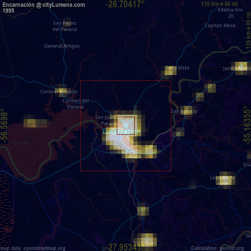
» NASA, Earths city lights 1995
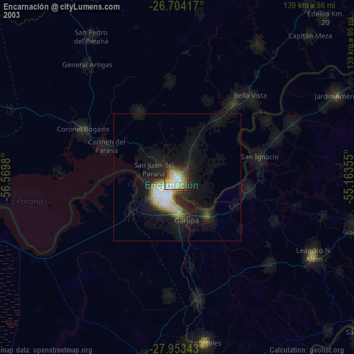
» NASA city lights 2003
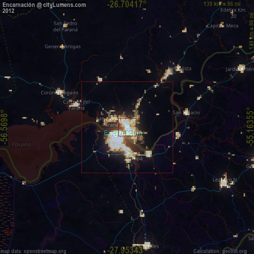
» Earth at Night: Flat Maps 2012, 2016