Ciudad del Este night lights from space
Night Light of Ciudad del Este (Alto Paraná) from space (Paraguay) Src. Average luminocity for 10x10km area is 95.4306% and for 50x50km: 21.142%.
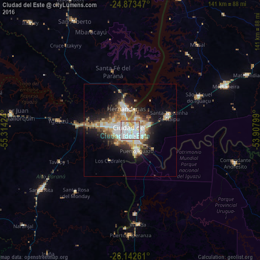
Analysis of Ciudad del Este night lights 2016
Square area 10x10 km:
 47.62%
90-99
33.53%80-89
11.11%70-79
5.56%60-69
2.18%50-59
0%40-49
0%30-39
0%20-29
0%10-19
0%0-9
0%Square area 50x50 km:
4.56%90-99
4.53%80-89
3.13%70-79
2.29%60-69
3.41%50-59
1.7%40-49
2.02%30-39
2.1%20-29
4.71%10-19
8.8%0-9
62.77%Clear (daylight) street map image can be seen on geolist.org.
Map coordinates:
24° 52' 24.5" South, 55° 18' 51.3" West
25° 30' 35" South, 54° 36' 40" West
26° 8' 33.4" South, 53° 54' 28.8" West
Some cities around Ciudad del Este sort by population:
• Foz do Iguaçu, BR
4.8 km =3 mi,  151°
151°
• Presidente Franco
6 km =3.7 mi,  179°
179°
• Puerto Iguazú, AR
10.6 km =6.6 mi,  159°
159°
• Puerto Esperanza, AR
57 km =35.4 mi, 180°
• Wanda, AR
51.3 km =31.9 mi,  174°
174°
• São Miguel do Iguaçu, BR
41.6 km =25.8 mi,  64°
64°
• Santa Rita
54.9 km =34.1 mi,  236°
236°
• Puerto Libertad, AR
45.7 km =28.4 mi, 176°
3439101 (p: 320,782)
Sources (retrieved 2019-11-25):
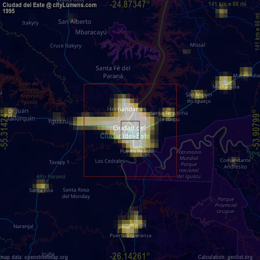
» NASA, Earths city lights 1995
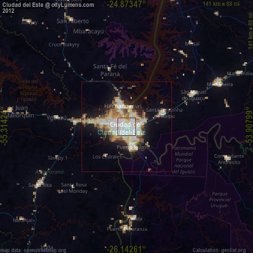
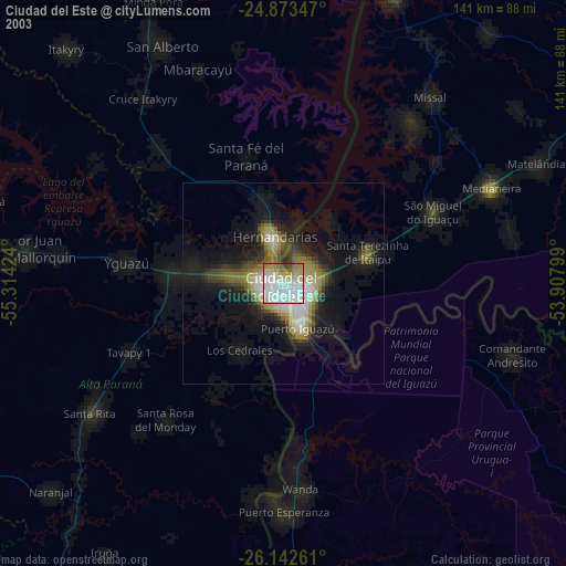
» NASA city lights 2003
» Earth at Night: Flat Maps 2012, 2016