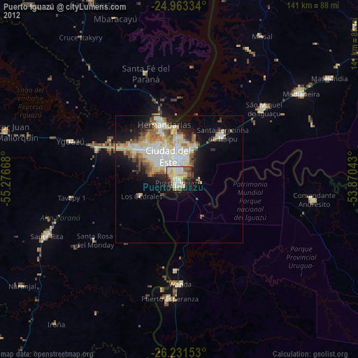
Puerto Iguazú night lights from space
Night Light of Puerto Iguazú (Misiones) from space (Argentina) Src. Average luminocity for 10x10km area is 62.9943% and for 50x50km: 20.1049%.
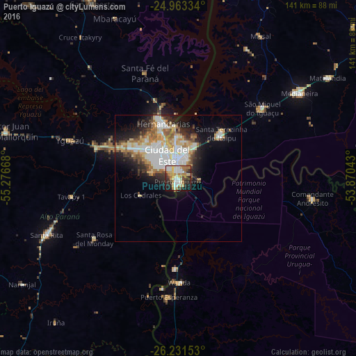
Analysis of Puerto Iguazú night lights 2016
Square area 10x10 km:
 12.5%
12.5%90-99
17.99%80-89
8.9%70-79
6.63%60-69
17.05%50-59
0.95%40-49
6.25%30-39
5.68%20-29
12.31%10-19
11.55%0-9
0.19%Square area 50x50 km:
4.6%90-99
4.54%80-89
2.94%70-79
2.19%60-69
3.1%50-59
1.56%40-49
1.86%30-39
1.86%20-29
4.33%10-19
7.33%0-9
65.69%Clear (daylight) street map image can be seen on geolist.org.
Map coordinates:
24° 57' 48" South, 55° 16' 36" West
25° 35' 56.8" South, 54° 34' 24.8" West
26° 13' 53.5" South, 53° 52' 13.5" West
Some cities around Puerto Iguazú sort by population:
• Ciudad del Este, PY
10.6 km =6.6 mi,  339°
339°
• Foz do Iguaçu, BR
5.9 km =3.7 mi,  345°
345°
• Presidente Franco, PY
5.4 km =3.4 mi,  316°
316°
• Medianeira, BR
58.8 km =36.5 mi,  54°
54°
• Wanda
41.1 km =25.5 mi,  178°
178°
• São Miguel do Iguaçu, BR
43.8 km =27.2 mi, 50°
• Santa Rita, PY
53.5 km =33.2 mi,  247°
247°
• Matelândia, BR
70.3 km =43.7 mi,  55°
55°
3429777 (p: 32,038)
Sources (retrieved 2019-11-25):
» Earth at Night: Flat Maps 2012, 2016