Valenza night lights from space
Night Light of Valenza (Viana do Castelo) from space (Portugal) Src. Average luminocity for 10x10km area is 25.7619% and for 50x50km: 20.7782%.
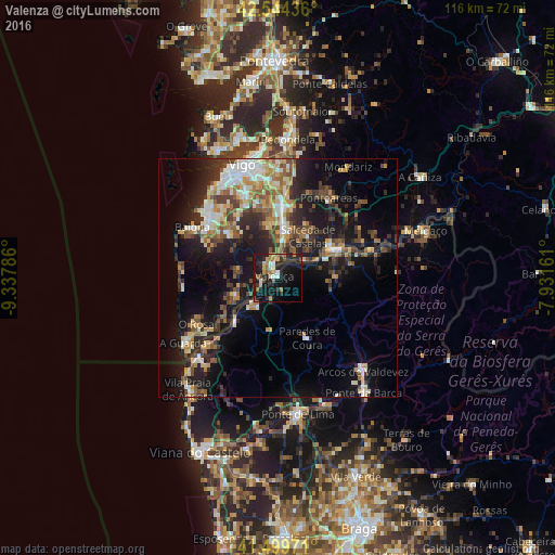
Analysis of Valenza night lights 2016
Square area 10x10 km:
 1.11%
1.11%90-99
3.97%80-89
3.65%70-79
3.02%60-69
3.02%50-59
4.29%40-49
2.54%30-39
2.22%20-29
11.59%10-19
39.05%0-9
25.56%Square area 50x50 km:
2.07%90-99
3.68%80-89
2.71%70-79
2.27%60-69
2.98%50-59
2.93%40-49
3.41%30-39
3.2%20-29
7.19%10-19
14.91%0-9
54.63%Clear (daylight) street map image can be seen on geolist.org.
Map coordinates:
42° 32' 39.7" North, 9° 20' 16.3" West
42° 1' 27" North, 8° 38' 5.1" West
41° 29' 59" North, 7° 55' 53.8" West
Some cities around Valenza sort by population:
• Monção
14.1 km =8.8 mi,  64°
64°
• Nigrán, ES
19.3 km =12 mi,  312°
312°
• Porriño, ES
15.3 km =9.5 mi,  4°
4°
• Tui, ES
2.7 km =1.7 mi,  342°
342°
• Gondomar, ES
13.6 km =8.5 mi,  315°
315°
• Tomiño, ES
10.7 km =6.6 mi,  247°
247°
• Salvatierra de Miño, ES
12.9 km =8 mi, 59°
• O Rosal, ES
19.4 km =12.1 mi,  239°
239°
6697257 (p: 14,172)
Sources (retrieved 2019-11-25):
» Earth at Night: Flat Maps 2012, 2016