Tui night lights from space
Night Light of Tui (Galicia) from space (Spain) Src. Average luminocity for 10x10km area is 31.2127% and for 50x50km: 21.3172%.
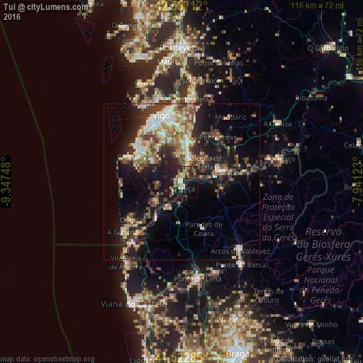
Analysis of Tui night lights 2016
Square area 10x10 km:
 1.11%
1.11%90-99
3.97%80-89
4.13%70-79
2.86%60-69
4.44%50-59
7.3%40-49
3.65%30-39
4.76%20-29
16.98%10-19
41.11%0-9
9.68%Square area 50x50 km:
2.22%90-99
3.83%80-89
2.65%70-79
2.41%60-69
3.11%50-59
3.08%40-49
3.62%30-39
3.44%20-29
7.16%10-19
14.54%0-9
53.93%Clear (daylight) street map image can be seen on geolist.org.
Map coordinates:
42° 34' 1.6" North, 9° 20' 50.9" West
42° 2' 49.7" North, 8° 38' 39.7" West
41° 31' 22.3" North, 7° 56' 28.4" West
Some cities around Tui sort by population:
• Ponteareas
18.3 km =11.4 mi,  39°
39°
• Monção, PT
14 km =8.7 mi,  75°
75°
• Nigrán
17 km =10.6 mi,  308°
308°
• Porriño
12.9 km =8 mi,  9°
9°
• Valenza, PT
2.7 km =1.7 mi,  162°
162°
• Gondomar
11.3 km =7 mi, 309°
• Tomiño
11.3 km =7 mi,  234°
234°
• Salvatierra de Miño
12.6 km =7.8 mi,  71°
71°
3107364 (p: 17,262)
Sources (retrieved 2019-11-25):
» Earth at Night: Flat Maps 2012, 2016