São João de Ver night lights from space
Night Light of São João de Ver (Aveiro) from space (Portugal) Src. Average luminocity for 10x10km area is 80.369% and for 50x50km: 37.5985%.
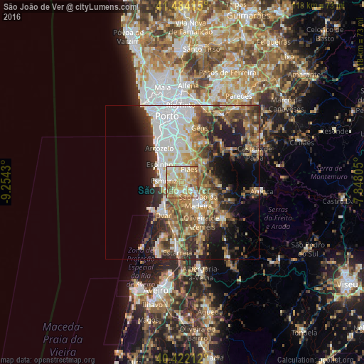
Analysis of São João de Ver night lights 2016
Square area 10x10 km:
 11.73%
90-99
21.94%80-89
18.71%70-79
22.62%60-69
18.2%50-59
4.76%40-49
2.04%30-39
0%20-29
0%10-19
0%0-9
0%Square area 50x50 km:
8.04%90-99
6.98%80-89
4.38%70-79
5.17%60-69
6.69%50-59
5.48%40-49
4.66%30-39
5.76%20-29
7.79%10-19
9.98%0-9
35.08%Clear (daylight) street map image can be seen on geolist.org.
Map coordinates:
41° 29' 2.9" North, 9° 15' 15.5" West
40° 57' 19" North, 8° 33' 4.2" West
40° 25' 19.6" North, 7° 50' 53" West
Some cities around São João de Ver sort by population:
• Feira
3.4 km =2.1 mi,  168°
168°
• Esmoriz
6.4 km =4 mi,  272°
272°
• Lourosa
3.2 km =2 mi,  359°
359°
• Fiães
4.9 km =3 mi,  26°
26°
• Arrifana
6.4 km =4 mi,  133°
133°
• Lobão
6.5 km =4 mi,  57°
57°
• Lamas
3.7 km =2.3 mi,  336°
336°
• Nogueira da Regedoura
6.5 km =4 mi,  328°
328°
2734473 (p: 9,568)
Sources (retrieved 2019-11-25):
» Earth at Night: Flat Maps 2012, 2016