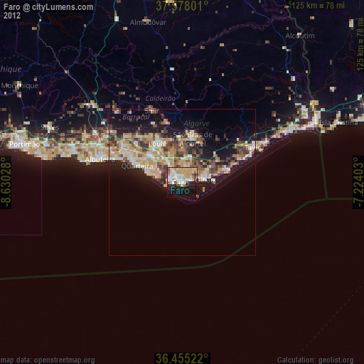
Faro night lights from space
Night Light of Faro from space (Portugal) Src. Average luminocity for 10x10km area is 48.0391% and for 50x50km: 15.8129%.
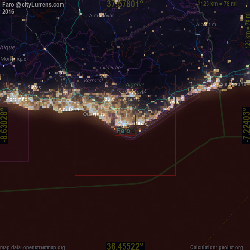
Analysis of Faro night lights 2016
Square area 10x10 km:
 8.33%
8.33%90-99
5.44%80-89
9.52%70-79
6.63%60-69
11.73%50-59
5.27%40-49
5.1%30-39
4.59%20-29
14.63%10-19
21.77%0-9
6.97%Square area 50x50 km:
1.35%90-99
1.3%80-89
2.7%70-79
1.97%60-69
3.99%50-59
2.15%40-49
2.45%30-39
3.66%20-29
5.26%10-19
10.14%0-9
65.04%Clear (daylight) street map image can be seen on geolist.org.
Map coordinates:
37° 34' 40.8" North, 8° 37' 49" West
37° 1' 7.3" North, 7° 55' 37.8" West
36° 27' 18.8" North, 7° 13' 26.5" West
Some cities around Faro sort by population:
• Olhão
7.7 km =4.8 mi,  81°
81°
• Loulé
15.6 km =9.7 mi,  328°
328°
• Laranjeiro
11.9 km =7.4 mi,  62°
62°
• Quarteira
16.4 km =10.2 mi,  290°
290°
• Tavira
27.5 km =17.1 mi, 63°
• São Brás de Alportel
15.4 km =9.6 mi,  13°
13°
• Almancil
11.9 km =7.4 mi,  309°
309°
• Moncarapacho
14.3 km =8.9 mi, 59°
2268339 (p: 41,355)
Sources (retrieved 2019-11-25):
» Earth at Night: Flat Maps 2012, 2016