Barreiro night lights from space
Night Light of Barreiro (District of Setúbal) from space (Portugal) Src. Average luminocity for 10x10km area is 68.3734% and for 50x50km: 45.9132%.
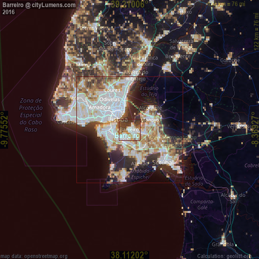
Analysis of Barreiro night lights 2016
Square area 10x10 km:
 20.62%
90-99
18.51%80-89
4.55%70-79
5.68%60-69
8.77%50-59
4.87%40-49
11.2%30-39
19.97%20-29
5.84%10-19
0%0-9
0%Square area 50x50 km:
14.45%90-99
11.52%80-89
4.15%70-79
4.99%60-69
5.55%50-59
4.37%40-49
3.47%30-39
5.02%20-29
8.7%10-19
8.9%0-9
28.88%Clear (daylight) street map image can be seen on geolist.org.
Map coordinates:
39° 12' 36.2" North, 9° 46' 31.9" West
38° 39' 47.3" North, 9° 4' 20.6" West
38° 6' 43.3" North, 8° 22' 9.4" West
Some cities around Barreiro sort by population:
• Amora
5.3 km =3.3 mi,  225°
225°
• Arrentela
4.9 km =3 mi,  210°
210°
• Lavradio
1.9 km =1.2 mi,  72°
72°
• Laranjeira
7.1 km =4.4 mi,  263°
263°
• Alhos Vedros
4.3 km =2.7 mi,  102°
102°
• Aldeia de Paio Pires
5.3 km =3.3 mi,  190°
190°
• Santo António da Charneca
5.5 km =3.4 mi,  138°
138°
• Cacilhas
7.2 km =4.5 mi,  291°
291°
2271071 (p: 51,280)
Sources (retrieved 2019-11-25):
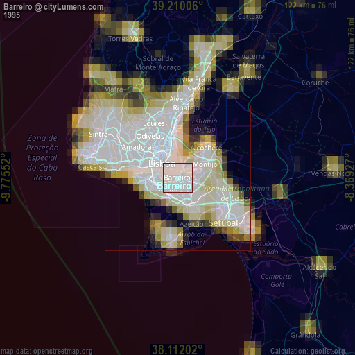
» NASA, Earths city lights 1995
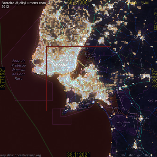
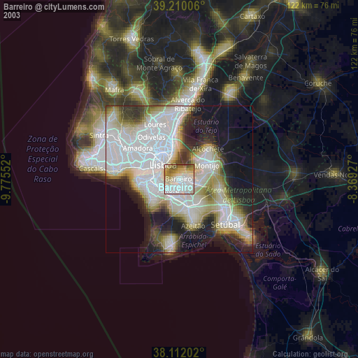
» NASA city lights 2003
» Earth at Night: Flat Maps 2012, 2016