Las Piedras night lights from space
Night Light of Las Piedras from space (Puerto Rico) Src. Average luminocity for 10x10km area is 59.2662% and for 50x50km: 35.6667%.
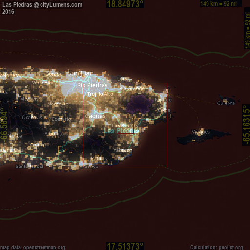
Analysis of Las Piedras night lights 2016
Square area 10x10 km:
 6.49%
6.49%90-99
6.06%80-89
5.84%70-79
12.55%60-69
16.88%50-59
14.29%40-49
16.45%30-39
12.55%20-29
8.87%10-19
0%0-9
0%Square area 50x50 km:
5.63%90-99
4.57%80-89
4.42%70-79
4.84%60-69
7.43%50-59
7.04%40-49
6.59%30-39
5.96%20-29
8.05%10-19
13.09%0-9
32.4%Clear (daylight) street map image can be seen on geolist.org.
Map coordinates:
18° 50' 59" North, 66° 34' 9.8" West
18° 10' 58.8" North, 65° 51' 58.6" West
17° 30' 49.4" North, 65° 9' 47.3" West
Some cities around Las Piedras sort by population:
• Humacao
5.5 km =3.4 mi,  132°
132°
• San Lorenzo
10 km =6.2 mi,  274°
274°
• Gurabo
13.8 km =8.6 mi,  305°
305°
• Juncos
7.6 km =4.7 mi, 310°
• Yabucoa
14.8 km =9.2 mi,  185°
185°
• Punta Santiago
12.6 km =7.8 mi,  98°
98°
• Naguabo
14.2 km =8.8 mi,  77°
77°
• Maunabo
19.9 km =12.4 mi, 190°
4565980 (p: 6,655)
Sources (retrieved 2019-11-25):
» Earth at Night: Flat Maps 2012, 2016