Juana Díaz night lights from space
Night Light of Juana Díaz from space (Puerto Rico) Src. Average luminocity for 10x10km area is 56.1537% and for 50x50km: 18.5701%.
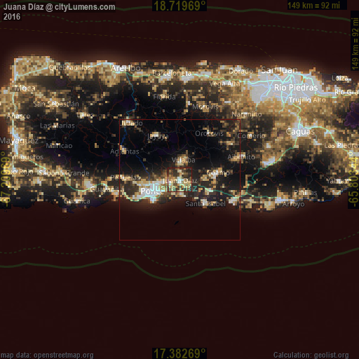
Analysis of Juana Díaz night lights 2016
Square area 10x10 km:
 3.9%
3.9%90-99
4.76%80-89
16.88%70-79
12.12%60-69
8.01%50-59
6.93%40-49
12.55%30-39
17.1%20-29
15.58%10-19
2.16%0-9
0%Square area 50x50 km:
1.75%90-99
2.06%80-89
3.3%70-79
2.3%60-69
2.43%50-59
1.74%40-49
2.68%30-39
4.78%20-29
7.07%10-19
15.14%0-9
56.75%Clear (daylight) street map image can be seen on geolist.org.
Map coordinates:
18° 43' 10.9" North, 67° 12' 34.9" West
18° 3' 8.9" North, 66° 30' 23.6" West
17° 22' 57.7" North, 65° 48' 12.4" West
Some cities around Juana Díaz sort by population:
• Ponce
13.3 km =8.3 mi,  249°
249°
• Coamo
16 km =9.9 mi,  78°
78°
• Santa Isabel
14.4 km =8.9 mi,  131°
131°
• Peñuelas
22.7 km =14.1 mi,  271°
271°
• Salinas
23.6 km =14.7 mi,  110°
110°
• Villalba
8.4 km =5.2 mi,  10°
10°
• Jayuya
20.5 km =12.7 mi,  334°
334°
• Orocovis
22.9 km =14.2 mi,  32°
32°
4565712 (p: 9,427)
Sources (retrieved 2019-11-25):
» Earth at Night: Flat Maps 2012, 2016