Wolsztyn night lights from space
Night Light of Wolsztyn (Greater Poland) from space (Poland) Src. Average luminocity for 10x10km area is 8.9775% and for 50x50km: 2.2546%.
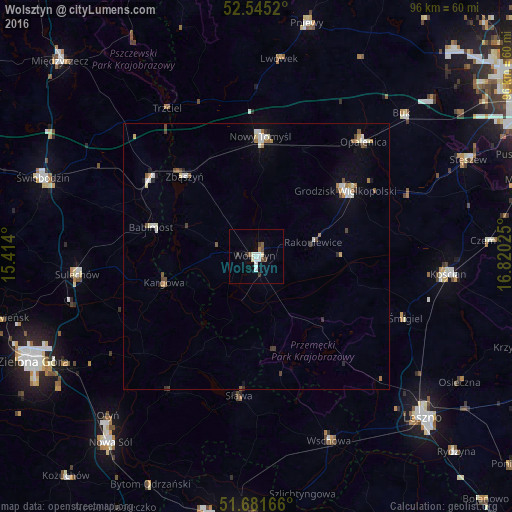
Analysis of Wolsztyn night lights 2016
Square area 10x10 km:
 1.59%
1.59%90-99
2.25%80-89
0.93%70-79
0%60-69
0.53%50-59
0.79%40-49
1.85%30-39
1.32%20-29
0.79%10-19
0.26%0-9
89.68%Square area 50x50 km:
0.36%90-99
0.4%80-89
0.26%70-79
0.12%60-69
0.32%50-59
0.27%40-49
0.35%30-39
0.24%20-29
0.16%10-19
0.35%0-9
97.17%Clear (daylight) street map image can be seen on geolist.org.
Map coordinates:
52° 32' 42.7" North, 15° 24' 50.4" East
52° 6' 55.9" North, 16° 7' 1.6" East
51° 40' 54" North, 16° 49' 12.9" East
Some cities around Wolsztyn sort by population:
• Kościan
36.4 km =22.6 mi,  94°
94°
• Sulechów
33.8 km =21 mi,  263°
263°
• Nowy Tomyśl
22.7 km =14.1 mi,  1°
1°
• Grodzisk Wielkopolski
21 km =13 mi,  53°
53°
• Opalenica
29.5 km =18.3 mi,  43°
43°
• Zbąszyń
19.9 km =12.4 mi,  319°
319°
• Śmigiel
30.2 km =18.8 mi,  112°
112°
• Zbąszynek
24.9 km =15.5 mi,  304°
304°
3081419 (p: 13,689)
Sources (retrieved 2019-11-25):
» Earth at Night: Flat Maps 2012, 2016