Opalenica night lights from space
Night Light of Opalenica (Greater Poland) from space (Poland) Src. Average luminocity for 10x10km area is 6.9306% and for 50x50km: 5.7454%.
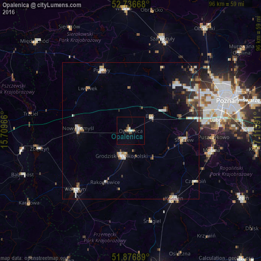
Analysis of Opalenica night lights 2016
Square area 10x10 km:
 0.76%
0.76%90-99
0.76%80-89
1.39%70-79
0.25%60-69
0.88%50-59
1.26%40-49
0.88%30-39
0.38%20-29
0%10-19
1.01%0-9
92.42%Square area 50x50 km:
0.88%90-99
1.02%80-89
0.57%70-79
0.36%60-69
0.74%50-59
0.68%40-49
0.69%30-39
0.85%20-29
1.1%10-19
3.16%0-9
89.95%Clear (daylight) street map image can be seen on geolist.org.
Map coordinates:
52° 44' 12" North, 15° 42' 34.8" East
52° 18' 31.9" North, 16° 24' 46" East
51° 52' 36.8" North, 17° 6' 57.3" East
Some cities around Opalenica sort by population:
• Kościan
29.3 km =18.2 mi,  146°
146°
• Nowy Tomyśl
19.4 km =12.1 mi,  273°
273°
• Grodzisk Wielkopolski
9.6 km =6 mi,  199°
199°
• Pniewy
24.7 km =15.3 mi,  334°
334°
• Buk
8.9 km =5.5 mi,  54°
54°
• Plewiska
27.7 km =17.2 mi,  76°
76°
• Stęszew
19.8 km =12.3 mi,  98°
98°
• Komorniki
27.2 km =16.9 mi, 83°
3090076 (p: 8,991)
Sources (retrieved 2019-11-25):
» Earth at Night: Flat Maps 2012, 2016