Trzebinia night lights from space
Night Light of Trzebinia (Lesser Poland) from space (Poland) Src. Average luminocity for 10x10km area is 31.2687% and for 50x50km: 21.2246%.
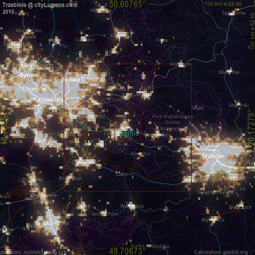
Analysis of Trzebinia night lights 2016
Square area 10x10 km:
 3.48%
3.48%90-99
5.61%80-89
3.48%70-79
4.81%60-69
3.34%50-59
3.07%40-49
6.28%30-39
5.48%20-29
10.29%10-19
25.8%0-9
28.34%Square area 50x50 km:
3.91%90-99
3.8%80-89
1.76%70-79
2.08%60-69
2.86%50-59
2.86%40-49
3.37%30-39
3.66%20-29
5.48%10-19
13.44%0-9
56.78%Clear (daylight) street map image can be seen on geolist.org.
Map coordinates:
50° 36' 27.5" North, 18° 45' 59.5" East
50° 9' 33.5" North, 19° 28' 10.8" East
49° 42' 24.2" North, 20° 10' 22" East
Some cities around Trzebinia sort by population:
• Jaworzno
14.8 km =9.2 mi,  290°
290°
• Chrzanów
5.5 km =3.4 mi,  241°
241°
• Olkusz
15.2 km =9.4 mi,  26°
26°
• Libiąż
12.6 km =7.8 mi, 240°
• Bukowno
11.7 km =7.3 mi,  356°
356°
• Krzeszowice
11.7 km =7.3 mi,  99°
99°
• Chełmek
17.1 km =10.6 mi,  247°
247°
• Sławków
16.6 km =10.3 mi,  339°
339°
3083111 (p: 18,828)
Sources (retrieved 2019-11-25):
» Earth at Night: Flat Maps 2012, 2016