Chrzanów night lights from space
Night Light of Chrzanów (Lesser Poland) from space (Poland) Src. Average luminocity for 10x10km area is 35.7794% and for 50x50km: 22.4681%.
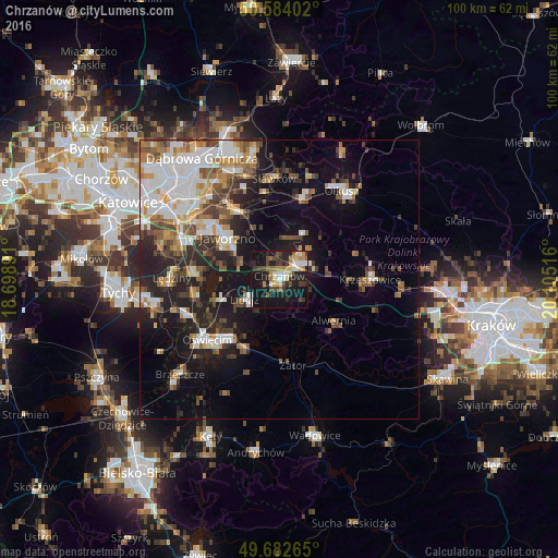
Analysis of Chrzanów night lights 2016
Square area 10x10 km:
 4.41%
4.41%90-99
6.28%80-89
3.74%70-79
5.35%60-69
5.35%50-59
1.87%40-49
7.49%30-39
4.95%20-29
12.83%10-19
38.77%0-9
8.96%Square area 50x50 km:
4.66%90-99
4.37%80-89
1.72%70-79
2.35%60-69
2.81%50-59
2.96%40-49
3.35%30-39
3.11%20-29
5.48%10-19
12.88%0-9
56.31%Clear (daylight) street map image can be seen on geolist.org.
Map coordinates:
50° 35' 2.5" North, 18° 41' 56.1" East
50° 8' 7.7" North, 19° 24' 7.3" East
49° 40' 57.5" North, 20° 6' 18.6" East
Some cities around Chrzanów sort by population:
• Jaworzno
11.9 km =7.4 mi,  310°
310°
• Trzebinia
5.5 km =3.4 mi,  61°
61°
• Libiąż
7.1 km =4.4 mi,  240°
240°
• Bukowno
14.9 km =9.3 mi,  15°
15°
• Krzeszowice
16.4 km =10.2 mi,  87°
87°
• Chełmek
11.6 km =7.2 mi,  251°
251°
• Imielin
15.4 km =9.6 mi,  274°
274°
• Chełm Śląski
15 km =9.3 mi,  258°
258°
3101547 (p: 39,973)
Sources (retrieved 2019-11-25):
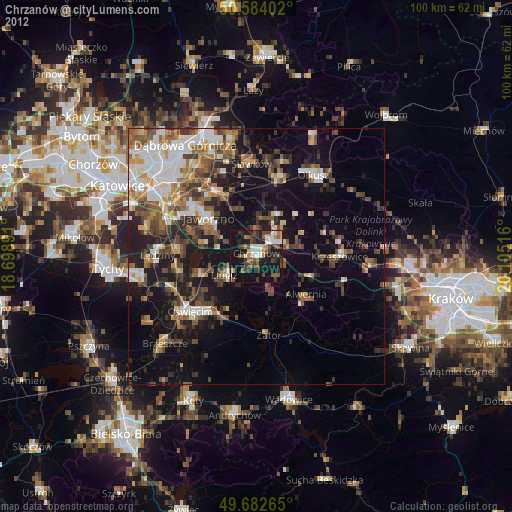
» Earth at Night: Flat Maps 2012, 2016