Pniewy night lights from space
Night Light of Pniewy (Greater Poland) from space (Poland) Src. Average luminocity for 10x10km area is 6.7593% and for 50x50km: 2.8479%.
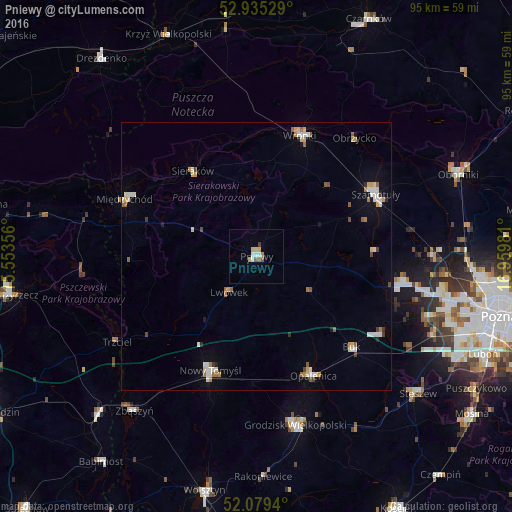
Analysis of Pniewy night lights 2016
Square area 10x10 km:
 0.93%
0.93%90-99
1.19%80-89
1.85%70-79
0.66%60-69
0.26%50-59
1.06%40-49
0.4%30-39
0.53%20-29
0%10-19
0%0-9
93.12%Square area 50x50 km:
0.47%90-99
0.49%80-89
0.4%70-79
0.26%60-69
0.37%50-59
0.42%40-49
0.18%30-39
0.21%20-29
0.13%10-19
0.5%0-9
96.56%Clear (daylight) street map image can be seen on geolist.org.
Map coordinates:
52° 56' 7" North, 15° 33' 12.8" East
52° 30' 33.9" North, 16° 15' 24" East
52° 4' 45.8" North, 16° 57' 35.3" East
Some cities around Pniewy sort by population:
• Szamotuły
24.5 km =15.2 mi,  62°
62°
• Nowy Tomyśl
22.8 km =14.2 mi,  202°
202°
• Grodzisk Wielkopolski
32.2 km =20 mi,  166°
166°
• Wronki
23.9 km =14.9 mi,  20°
20°
• Międzychód
26.3 km =16.3 mi,  292°
292°
• Opalenica
24.7 km =15.3 mi,  154°
154°
• Buk
24.7 km =15.3 mi,  133°
133°
• Sieraków
19.8 km =12.3 mi,  322°
322°
3088759 (p: 7,738)
Sources (retrieved 2019-11-25):
» Earth at Night: Flat Maps 2012, 2016