Mikołów night lights from space
Night Light of Mikołów (Silesia) from space (Poland) Src. Average luminocity for 10x10km area is 53.7246% and for 50x50km: 44.2325%.

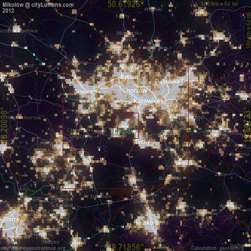
Analysis of Mikołów night lights 2016
Square area 10x10 km:
 9.63%
9.63%90-99
13.1%80-89
1.2%70-79
4.81%60-69
9.49%50-59
8.42%40-49
6.42%30-39
18.45%20-29
28.07%10-19
0.4%0-9
0%Square area 50x50 km:
10.82%90-99
10.69%80-89
3.3%70-79
4.35%60-69
5.14%50-59
5%40-49
5.75%30-39
7.21%20-29
12.22%10-19
15.54%0-9
19.98%Clear (daylight) street map image can be seen on geolist.org.
Map coordinates:
50° 37' 9.3" North, 18° 12' 3.5" East
50° 10' 15.7" North, 18° 54' 14.8" East
49° 43' 6.8" North, 19° 36' 26" East
Some cities around Mikołów sort by population:
• Katowice
13.1 km =8.1 mi,  42°
42°
• Ruda Śląska
10.3 km =6.4 mi,  340°
340°
• Tychy
5.8 km =3.6 mi,  130°
130°
• Świętochłowice
14 km =8.7 mi,  3°
3°
• Łaziska Górne
5 km =3.1 mi,  241°
241°
• Orzesze
9.1 km =5.7 mi,  259°
259°
• Murcki
10.4 km =6.5 mi,  71°
71°
• Ornontowice
11 km =6.8 mi,  283°
283°
3091831 (p: 38,821)
Sources (retrieved 2019-11-25):
» Earth at Night: Flat Maps 2012, 2016