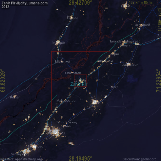
Zahir Pir night lights from space
Night Light of Zahir Pir (Punjab) from space (Pakistan) Src. Average luminocity for 10x10km area is 6.6837% and for 50x50km: 2.9264%.
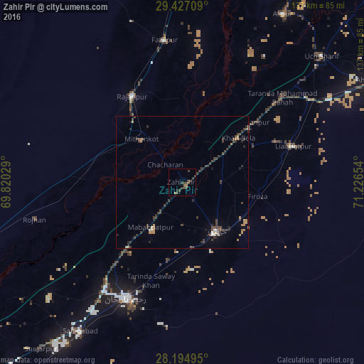
Analysis of Zahir Pir night lights 2016
Square area 10x10 km:
 0%
0%90-99
0%80-89
0.76%70-79
0%60-69
0.76%50-59
1.52%40-49
4.36%30-39
4.92%20-29
0.95%10-19
0.19%0-9
86.55%Square area 50x50 km:
0.09%90-99
0.19%80-89
0.25%70-79
0.3%60-69
0.35%50-59
0.31%40-49
1.35%30-39
1.11%20-29
0.68%10-19
0.47%0-9
94.9%Clear (daylight) street map image can be seen on geolist.org.
Map coordinates:
29° 25' 37.5" North, 69° 49' 13" East
28° 48' 46.2" North, 70° 31' 24.3" East
28° 11' 41.8" North, 71° 13' 35.5" East
Some cities around Zahir Pir sort by population:
• Rahim Yar Khan
48.7 km =30.3 mi,  206°
206°
• Saddiqabad
68.1 km =42.3 mi, 214°
• Khanpur
22.5 km =14 mi,  144°
144°
• Ahmadpur East
80.3 km =49.9 mi,  62°
62°
• Rajanpur
37.5 km =23.3 mi,  329°
329°
• Alipur
73.7 km =45.8 mi,  30°
30°
• Kot Samaba
29.5 km =18.3 mi,  190°
190°
• Rojhan
57.3 km =35.6 mi,  255°
255°
1162275 (p: 34,121)
Sources (retrieved 2019-11-25):
» Earth at Night: Flat Maps 2012, 2016