Daromehar night lights from space
Night Light of Daromehar (Sindh) from space (Pakistan) Src. Average luminocity for 10x10km area is 1.142% and for 50x50km: 1.0566%.
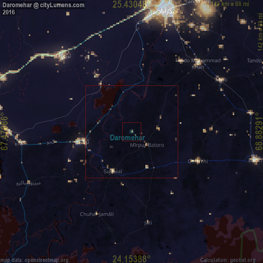
Analysis of Daromehar night lights 2016
Square area 10x10 km:
 0%
0%90-99
0%80-89
0%70-79
0%60-69
0.76%50-59
0%40-49
0%30-39
0.76%20-29
0%10-19
2.08%0-9
96.4%Square area 50x50 km:
0%90-99
0%80-89
0.16%70-79
0.17%60-69
0.25%50-59
0.29%40-49
0.18%30-39
0.31%20-29
0.27%10-19
0.32%0-9
98.06%Clear (daylight) street map image can be seen on geolist.org.
Map coordinates:
25° 25' 49.7" North, 67° 28' 36" East
24° 47' 37.8" North, 68° 10' 47.2" East
24° 9' 14" North, 68° 52' 58.5" East
Some cities around Daromehar sort by population:
• Tando Muhammad Khan
51.4 km =31.9 mi,  44°
44°
• Matli
55.4 km =34.4 mi,  60°
60°
• Thatta
26.4 km =16.4 mi,  258°
258°
• Gharo
60.3 km =37.5 mi, 264°
• Chuhar Jamali
48.3 km =30 mi,  203°
203°
• Jati
49.6 km =30.8 mi,  169°
169°
• Mirpur Bhtoro
10.9 km =6.8 mi,  131°
131°
• Kario Ghanwar
42.9 km =26.7 mi,  87°
87°
1180491 (p: 10,869)
Sources (retrieved 2019-11-25):
» Earth at Night: Flat Maps 2012, 2016