Sillanwali night lights from space
Night Light of Sillanwali (Punjab) from space (Pakistan) Src. Average luminocity for 10x10km area is 1.4267% and for 50x50km: 3.5244%.
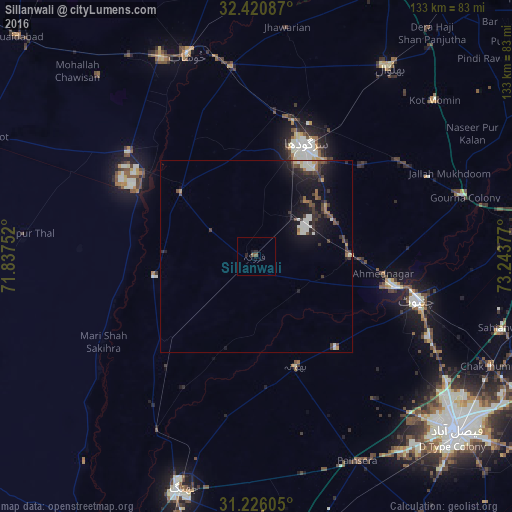
Analysis of Sillanwali night lights 2016
Square area 10x10 km:
 0%
0%90-99
0%80-89
0%70-79
0%60-69
0%50-59
1.47%40-49
0%30-39
0%20-29
1.47%10-19
0.73%0-9
96.34%Square area 50x50 km:
0.29%90-99
0.76%80-89
0.14%70-79
0.27%60-69
0.35%50-59
0.34%40-49
0.78%30-39
0.88%20-29
0.95%10-19
3.77%0-9
91.48%Clear (daylight) street map image can be seen on geolist.org.
Map coordinates:
32° 25' 15.1" North, 71° 50' 15.1" East
31° 49' 31.4" North, 72° 32' 26.3" East
31° 13' 33.8" North, 73° 14' 37.6" East
Some cities around Sillanwali sort by population:
• Sargodha
31.6 km =19.6 mi,  23°
23°
• Chenab Nagar
36.1 km =22.4 mi,  102°
102°
• Sahiwal
25.8 km =16 mi,  309°
309°
• Lalian
24.6 km =15.3 mi,  90°
90°
• Jahanian Shah
25 km =15.5 mi,  264°
264°
• Faruka
13.8 km =8.6 mi,  299°
299°
• Mangla
16.8 km =10.4 mi, 296°
• Bhawana
30.3 km =18.8 mi,  160°
160°
1164825 (p: 27,023)
Sources (retrieved 2019-11-25):
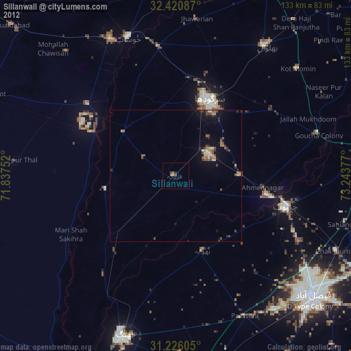
» Earth at Night: Flat Maps 2012, 2016