Shorkot night lights from space
Night Light of Shorkot (Khyber Pakhtunkhwa) from space (Pakistan) Src. Average luminocity for 10x10km area is 4.4913% and for 50x50km: 2.0599%.
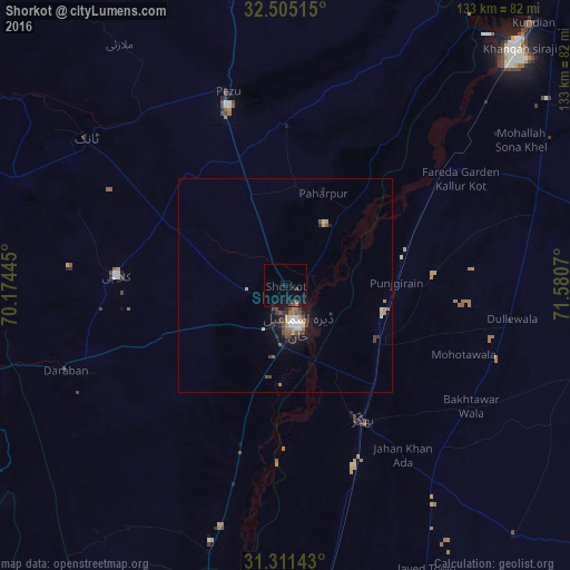
Analysis of Shorkot night lights 2016
Square area 10x10 km:
 0%
0%90-99
0%80-89
0%70-79
0%60-69
0.7%50-59
0%40-49
2.1%30-39
1.4%20-29
0.7%10-19
7.87%0-9
87.24%Square area 50x50 km:
0.09%90-99
0.35%80-89
0.17%70-79
0.22%60-69
0.33%50-59
0.24%40-49
0.56%30-39
0.41%20-29
0.4%10-19
1.54%0-9
95.67%Clear (daylight) street map image can be seen on geolist.org.
Map coordinates:
32° 30' 18.5" North, 70° 10' 28" East
31° 54' 36.8" North, 70° 52' 39.3" East
31° 18' 41.1" North, 71° 34' 50.5" East
Some cities around Shorkot sort by population:
• Dera Ismail Khan
9.1 km =5.7 mi,  165°
165°
• Bhakkar
36.1 km =22.4 mi,  150°
150°
• Dullewala
53.4 km =33.2 mi,  99°
99°
• Tank
57.7 km =35.9 mi,  306°
306°
• Kalur Kot
45.7 km =28.4 mi,  53°
53°
• Kulachi
39.5 km =24.5 mi,  273°
273°
• Paharpur
23.4 km =14.5 mi,  22°
22°
• Darya Khan
25.4 km =15.8 mi,  123°
123°
1164987 (p: 67,439)
Sources (retrieved 2019-11-25):
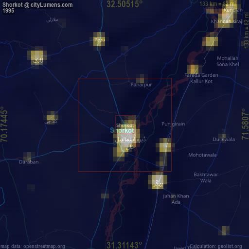
» NASA, Earths city lights 1995
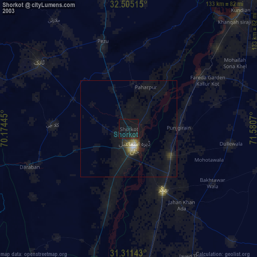
» NASA city lights 2003
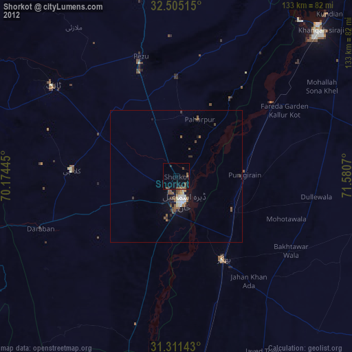
» Earth at Night: Flat Maps 2012, 2016