Mailsi night lights from space
Night Light of Mailsi (Punjab) from space (Pakistan) Src. Average luminocity for 10x10km area is 8.5655% and for 50x50km: 2.3273%.
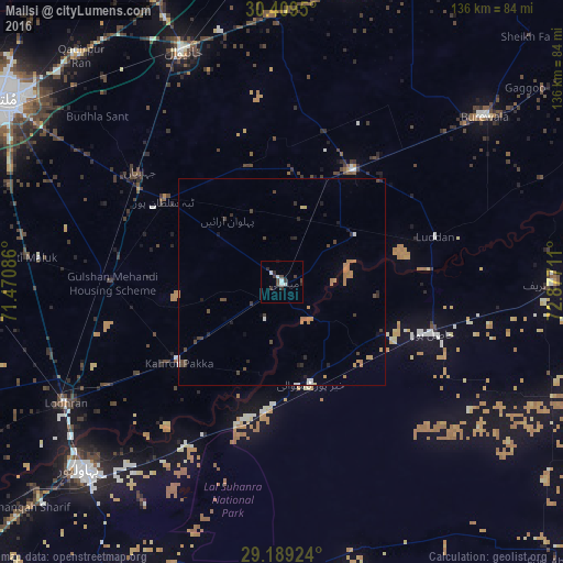
Analysis of Mailsi night lights 2016
Square area 10x10 km:
 1.19%
1.19%90-99
2.78%80-89
0%70-79
0%60-69
0%50-59
0%40-49
2.78%30-39
3.77%20-29
2.18%10-19
0.4%0-9
86.9%Square area 50x50 km:
0.13%90-99
0.25%80-89
0.06%70-79
0.37%60-69
0.69%50-59
0.02%40-49
0.69%30-39
0.41%20-29
0.48%10-19
0.35%0-9
96.55%Clear (daylight) street map image can be seen on geolist.org.
Map coordinates:
30° 24' 34.2" North, 71° 28' 15.1" East
29° 48' 4.4" North, 72° 10' 26.3" East
29° 11' 21.3" North, 72° 52' 37.6" East
Some cities around Mailsi sort by population:
• Būrewāla
61.3 km =38.1 mi,  48°
48°
• Vihari
32.2 km =20 mi,  32°
32°
• Lodhran
60.2 km =37.4 mi,  240°
240°
• Hasilpur
37.9 km =23.5 mi,  108°
108°
• Kahror Pakka
31.9 km =19.8 mi,  231°
231°
• Dunyapur
41.5 km =25.8 mi,  270°
270°
• Khairpur Tamewah
25.2 km =15.7 mi,  165°
165°
• Dhanot
47.6 km =29.6 mi, 238°
1171502 (p: 64,545)
Sources (retrieved 2019-11-25):
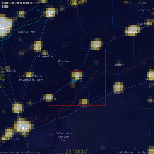
» NASA, Earths city lights 1995
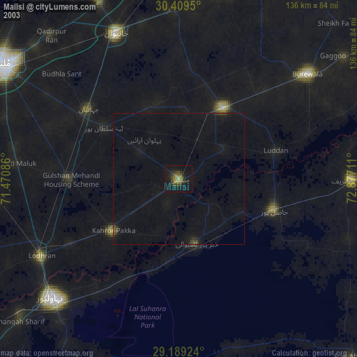
» NASA city lights 2003
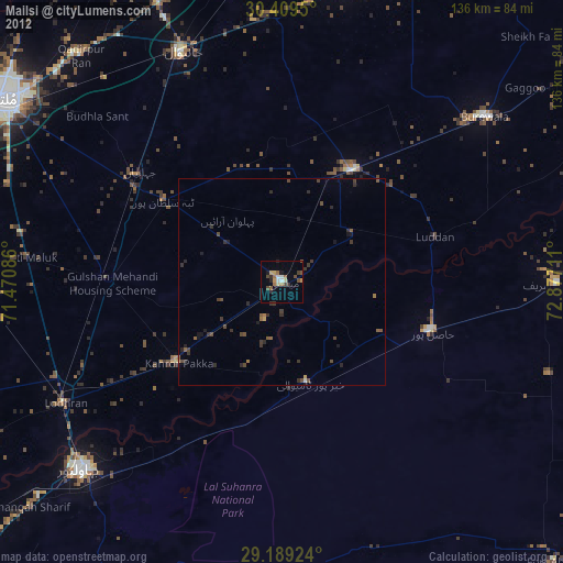
» Earth at Night: Flat Maps 2012, 2016