Gujranwala night lights from space
Night Light of Gujranwala (Punjab) from space (Pakistan) Src. Average luminocity for 10x10km area is 83.7867% and for 50x50km: 13.9317%.
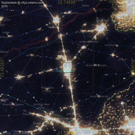
Analysis of Gujranwala night lights 2016
Square area 10x10 km:
 10.66%
90-99
58.04%80-89
6.82%70-79
3.85%60-69
2.8%50-59
5.42%40-49
4.9%30-39
5.07%20-29
2.45%10-19
0%0-9
0%Square area 50x50 km:
1.04%90-99
4.59%80-89
1.29%70-79
0.94%60-69
1.11%50-59
1.69%40-49
2.62%30-39
2.59%20-29
4.14%10-19
7.33%0-9
72.66%Clear (daylight) street map image can be seen on geolist.org.
Map coordinates:
32° 44' 56.4" North, 73° 29' 2.1" East
32° 9' 20.4" North, 74° 11' 13.4" East
31° 33' 30.5" North, 74° 53' 24.6" East
Some cities around Gujranwala sort by population:
• Kamoke
20.3 km =12.6 mi,  170°
170°
• Daska Kalan
24.2 km =15 mi,  39°
39°
• Wazirabad
32.6 km =20.3 mi,  348°
348°
• Naushahra Virkan
29.6 km =18.4 mi,  223°
223°
• Ladhewala Waraich
6.7 km =4.2 mi,  271°
271°
• Eminabad
14.3 km =8.9 mi,  151°
151°
• Dhaunkal
28.2 km =17.5 mi, 350°
• Begowala
32.3 km =20.1 mi,  13°
13°
1177662 (p: 1,384,471)
Sources (retrieved 2019-11-25):
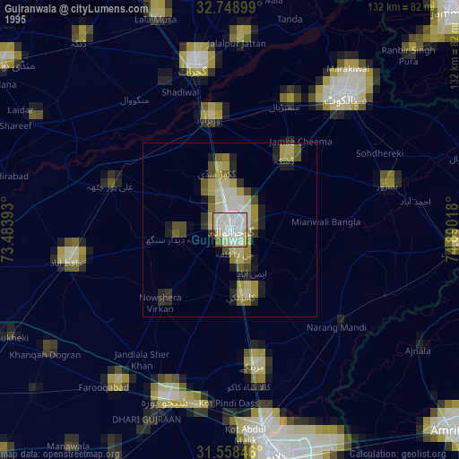
» NASA, Earths city lights 1995
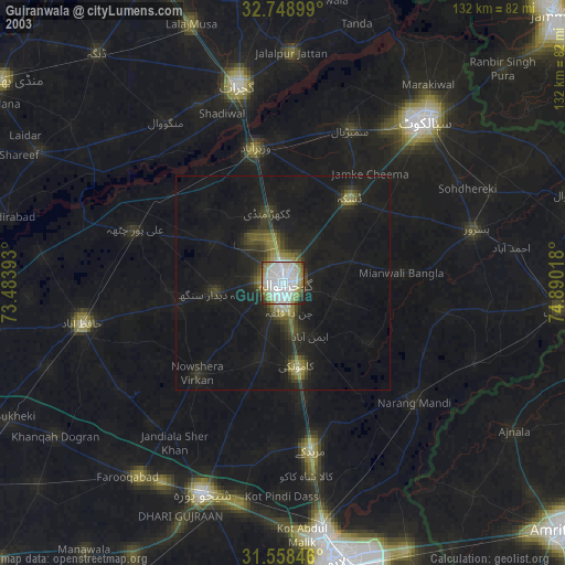
» NASA city lights 2003
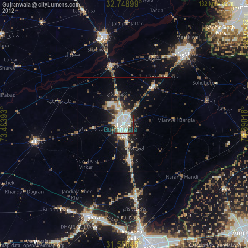
» Earth at Night: Flat Maps 2012, 2016