Bahawalpur night lights from space
Night Light of Bahawalpur (Punjab) from space (Pakistan) Src. Average luminocity for 10x10km area is 59.2443% and for 50x50km: 11.7627%.
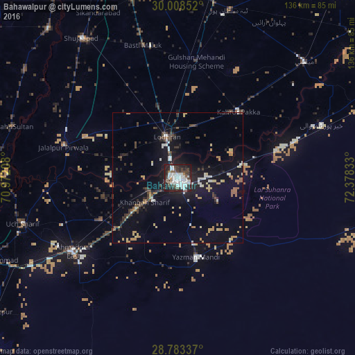
Analysis of Bahawalpur night lights 2016
Square area 10x10 km:
 16.86%
90-99
24.05%80-89
0%70-79
0.38%60-69
2.65%50-59
3.41%40-49
13.64%30-39
7.39%20-29
20.64%10-19
10.98%0-9
0%Square area 50x50 km:
1.22%90-99
1.9%80-89
1.11%70-79
1.44%60-69
1.11%50-59
0.9%40-49
2.08%30-39
1.61%20-29
2.84%10-19
9.74%0-9
76.05%Clear (daylight) street map image can be seen on geolist.org.
Map coordinates:
30° 0' 30.7" North, 70° 58' 19.5" East
29° 23' 52" North, 71° 40' 30.7" East
28° 47' 0.1" North, 72° 22' 42" East
Some cities around Bahawalpur sort by population:
• Ahmadpur East
49.4 km =30.7 mi,  234°
234°
• Lodhran
15.7 km =9.8 mi,  344°
344°
• Kahror Pakka
34.2 km =21.3 mi,  42°
42°
• Jalalpur Pirwala
45.5 km =28.3 mi,  285°
285°
• Dunyapur
45.5 km =28.3 mi,  8°
8°
• Khairpur Tamewah
58.2 km =36.2 mi,  69°
69°
• Yazman
31.5 km =19.6 mi,  167°
167°
• Dhanot
21.6 km =13.4 mi,  20°
20°
1183880 (p: 552,607)
Sources (retrieved 2019-11-25):
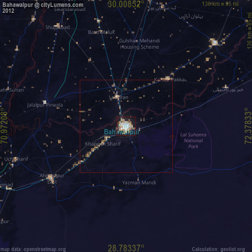
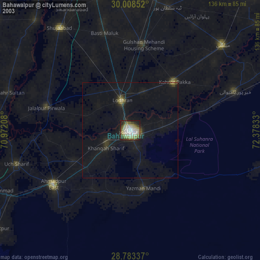
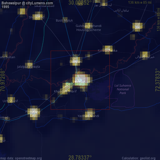
» NASA, Earths city lights 1995
» NASA city lights 2003
» Earth at Night: Flat Maps 2012, 2016