Tarlac City night lights from space
Night Light of Tarlac City (Central Luzon) from space (Philippines) Src. Average luminocity for 10x10km area is 47.1861% and for 50x50km: 5.6938%.
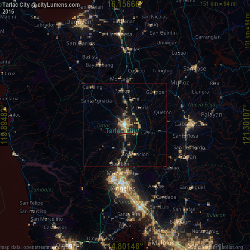
Analysis of Tarlac City night lights 2016
Square area 10x10 km:
 1.52%
1.52%90-99
5.19%80-89
4.98%70-79
13.85%60-69
16.45%50-59
4.33%40-49
5.84%30-39
10.82%20-29
18.18%10-19
18.83%0-9
0%Square area 50x50 km:
0.06%90-99
0.23%80-89
0.41%70-79
1.22%60-69
1.18%50-59
0.85%40-49
1.22%30-39
1.51%20-29
1.59%10-19
4.75%0-9
86.98%Clear (daylight) street map image can be seen on geolist.org.
Map coordinates:
16° 9' 24" North, 119° 53' 41.4" East
15° 28' 48.6" North, 120° 35' 52.6" East
14° 48' 5.3" North, 121° 18' 3.9" East
Some cities around Tarlac City sort by population:
• Gerona
14 km =8.7 mi,  359°
359°
• San Miguel
4 km =2.5 mi,  178°
178°
• San Nicolas
14.3 km =8.9 mi,  36°
36°
• Cut-cut Primero
1.3 km =0.8 mi,  282°
282°
• San Manuel
7.3 km =4.5 mi,  80°
80°
• Balingcanaway
9.4 km =5.8 mi,  88°
88°
• Mapalacsiao
8.2 km =5.1 mi,  134°
134°
• Murcia
8.5 km =5.3 mi,  171°
171°
1682812 (p: 183,930)
Sources (retrieved 2019-11-25):
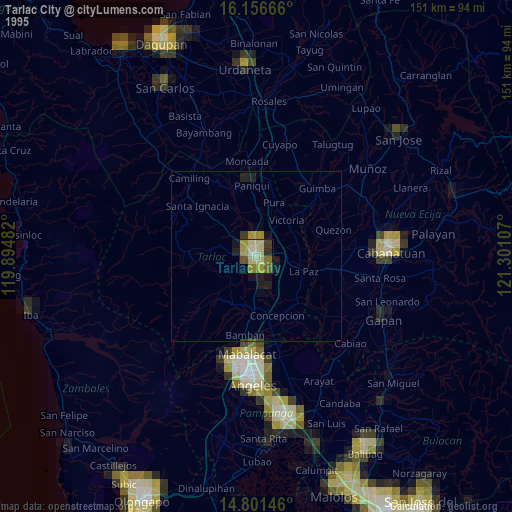
» NASA, Earths city lights 1995
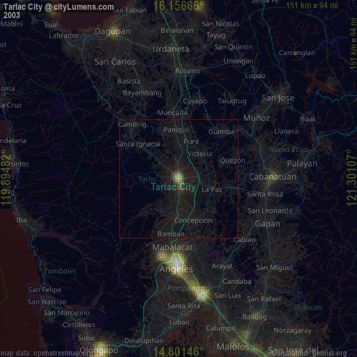
» NASA city lights 2003
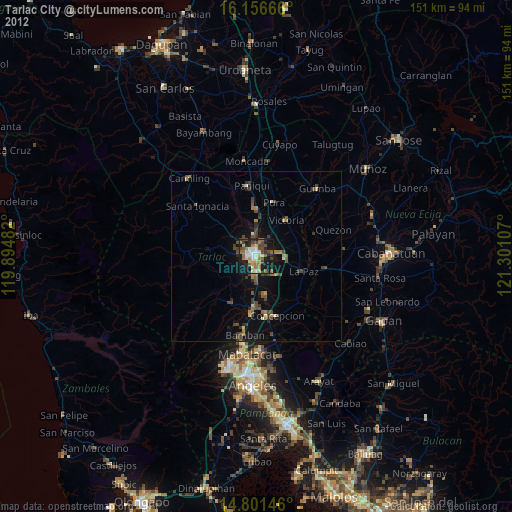
» Earth at Night: Flat Maps 2012, 2016