Sapu Padidu night lights from space
Night Light of Sapu Padidu (Soccsksargen) from space (Philippines) Src. Average luminocity for 10x10km area is 0.0165% and for 50x50km: 4.1873%.
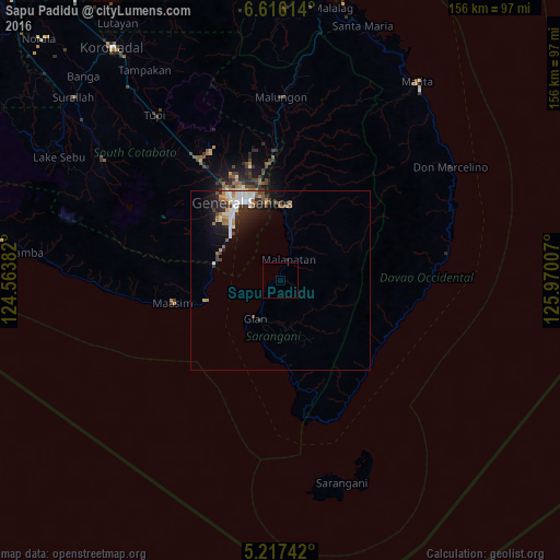
Analysis of Sapu Padidu night lights 2016
Square area 10x10 km:
 0%
0%90-99
0%80-89
0%70-79
0%60-69
0%50-59
0%40-49
0%30-39
0%20-29
0%10-19
0%0-9
100%Square area 50x50 km:
0.73%90-99
0.94%80-89
0.27%70-79
0.39%60-69
0.69%50-59
0.45%40-49
0.45%30-39
0.51%20-29
1.19%10-19
2.67%0-9
91.7%Clear (daylight) street map image can be seen on geolist.org.
Map coordinates:
6° 36' 58.1" North, 124° 33' 49.8" East
5° 55' 2" North, 125° 16' 1" East
5° 13' 2.7" North, 125° 58' 12.3" East
Some cities around Sapu Padidu sort by population:
• Alabel
20.7 km =12.9 mi,  7°
7°
• Glan
12.5 km =7.8 mi,  214°
214°
• Malapatan
6.3 km =3.9 mi,  23°
23°
• Buayan
22.4 km =13.9 mi,  350°
350°
• Lun Pequeño
13.5 km =8.4 mi, 7°
• Suyan
20.6 km =12.8 mi,  39°
39°
• Baliton
19.6 km =12.2 mi,  189°
189°
• Pangyan
24.1 km =15 mi,  176°
176°
1687203 (p: 9,789)
Sources (retrieved 2019-11-25):
» Earth at Night: Flat Maps 2012, 2016