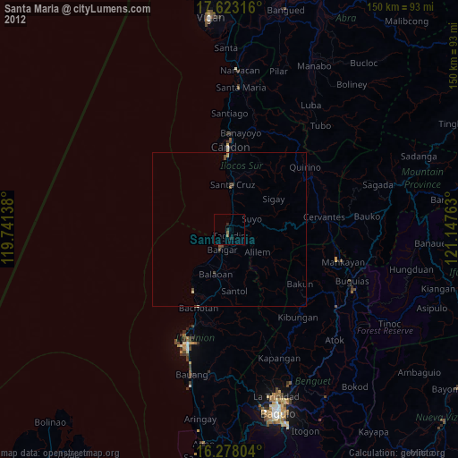
Santa Maria night lights from space
Night Light of Santa Maria (Ilocos) from space (Philippines) Src. Average luminocity for 10x10km area is 1.8442% and for 50x50km: 0.3516%.
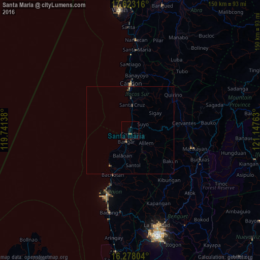
Analysis of Santa Maria night lights 2016
Square area 10x10 km:
 0%
0%90-99
0%80-89
0%70-79
0.87%60-69
0.87%50-59
0%40-49
0%30-39
0.87%20-29
0.22%10-19
0.65%0-9
96.54%Square area 50x50 km:
0%90-99
0%80-89
0.03%70-79
0.11%60-69
0.05%50-59
0.02%40-49
0.09%30-39
0.25%20-29
0.02%10-19
0.18%0-9
99.27%Clear (daylight) street map image can be seen on geolist.org.
Map coordinates:
17° 37' 23.4" North, 119° 44' 29" East
16° 57' 6.5" North, 120° 26' 40.2" East
16° 16' 40.9" North, 121° 8' 51.5" East
Some cities around Santa Maria sort by population:
• San Fernando
39.8 km =24.7 mi,  200°
200°
• Tagudin
1.8 km =1.1 mi,  181°
181°
• Mankayan
37.3 km =23.2 mi,  105°
105°
• Candon
27 km =16.8 mi,  1°
1°
• Bangar
6.8 km =4.2 mi, 198°
• Suyo
9 km =5.6 mi,  72°
72°
• Kibungan
36.3 km =22.6 mi,  141°
141°
• Rimus
9.8 km =6.1 mi,  211°
211°
1688017 (p: 28,002)
Sources (retrieved 2019-11-25):
» Earth at Night: Flat Maps 2012, 2016