Sangali night lights from space
Night Light of Sangali (Zamboanga Peninsula) from space (Philippines) Src. Average luminocity for 10x10km area is 6.2403% and for 50x50km: 3.3437%.
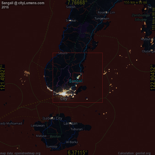
Analysis of Sangali night lights 2016
Square area 10x10 km:
 0.22%
0.22%90-99
0.65%80-89
1.3%70-79
1.3%60-69
1.73%50-59
0%40-49
1.73%30-39
0.65%20-29
1.08%10-19
0.43%0-9
90.91%Square area 50x50 km:
0.22%90-99
0.67%80-89
0.47%70-79
0.4%60-69
0.42%50-59
0.29%40-49
0.47%30-39
0.43%20-29
0.49%10-19
3.3%0-9
92.83%Clear (daylight) street map image can be seen on geolist.org.
Map coordinates:
7° 46' 0" North, 121° 29' 53.8" East
7° 4' 10" North, 122° 12' 5" East
6° 22' 16.1" North, 122° 54' 16.3" East
Some cities around Sangali sort by population:
• Mercedes
13.6 km =8.5 mi,  205°
205°
• Manicahan
5.6 km =3.5 mi,  180°
180°
• Taluksangay
13 km =8.1 mi,  188°
188°
• Curuan
15.5 km =9.6 mi,  13°
13°
• Bunguiao
3.9 km =2.4 mi,  351°
351°
• Buenavista
19.5 km =12.1 mi,  17°
17°
• Culianan
11.6 km =7.2 mi, 211°
• Bolong
5.3 km =3.3 mi,  52°
52°
1957309 (p: 14,727)
Sources (retrieved 2019-11-25):
» Earth at Night: Flat Maps 2012, 2016