Curuan night lights from space
Night Light of Curuan (Zamboanga Peninsula) from space (Philippines) Src. Average luminocity for 10x10km area is 0% and for 50x50km: 0.5183%.
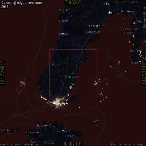
Analysis of Curuan night lights 2016
Square area 10x10 km:
 0%
0%90-99
0%80-89
0%70-79
0%60-69
0%50-59
0%40-49
0%30-39
0%20-29
0%10-19
0%0-9
100%Square area 50x50 km:
0.01%90-99
0.08%80-89
0.09%70-79
0.05%60-69
0.1%50-59
0.07%40-49
0.1%30-39
0.05%20-29
0.08%10-19
0.11%0-9
99.26%Clear (daylight) street map image can be seen on geolist.org.
Map coordinates:
7° 54' 8.3" North, 121° 31' 47.8" East
7° 12' 19" North, 122° 13' 59" East
6° 30' 25.9" North, 122° 56' 10.3" East
Some cities around Curuan sort by population:
• Sangali
15.5 km =9.6 mi,  193°
193°
• Vitali
19.4 km =12.1 mi,  18°
18°
• Manicahan
21 km =13 mi, 189°
• Taluksangay
28.4 km =17.6 mi, 190°
• Bunguiao
11.9 km =7.4 mi,  199°
199°
• Buenavista
4.2 km =2.6 mi,  35°
35°
• Culianan
26.8 km =16.7 mi, 200°
• Bolong
11.9 km =7.4 mi,  176°
176°
1716440 (p: 6,775)
Sources (retrieved 2019-11-25):
» Earth at Night: Flat Maps 2012, 2016